This short out and back walk of about 2.5 miles involves a modest climb on track and footpath leading to a ruined shepherd’s house with an Iron Age hillfort and burial cists en route. The walk could be extended to further explore the open moorland beyond the ruin and other points of interest which I’ll mention.
Start point is Old Bewick Farm, about 20mins drive from Honey Nuc. Take the A1 south and then first right after about quarter of a mile onto the B6348 for Chatton. When you’re almost through Chatton village take a left heading south on the B6346 toward Alnwick. You’ll pass through Chillingham on this road and after approximately another 3miles and a series of bends in the road at the crest of a hill reach Old Bewick Farm at the left hand side of the road. Postcode NE66 4DZ and Grid Ref NU 0666 2150.
Park with consideration on the verges by the farm buildings at the roadside. Start the walk by keeping to the track closest to the farm cottages. You’ll see Bewick Hill and Hanging Crag with Scots Pine trees overlooking the farm to the right. Old Bewick Hillfort is atop the hill to the right side of the crags. From the gateway at the foot of the hill there is supposedly a footpath which branches from the track, contours the hill and comes to the hillfort. My friend and I found that this petered out and was overgrown with bracken. We backtracked, continued up the track toward the back of the hill then bore off to the right and approached the hilltop via the small rectangular plantation of trees there. Atop Hanging Crag gives a splendid view of the Cheviot Hills. The Iron Age hillfort is a series of raised earthworks. There are more recent fortifications in the form of WW2 pillboxes and cup and ring rock markings on nearby freestanding boulders.
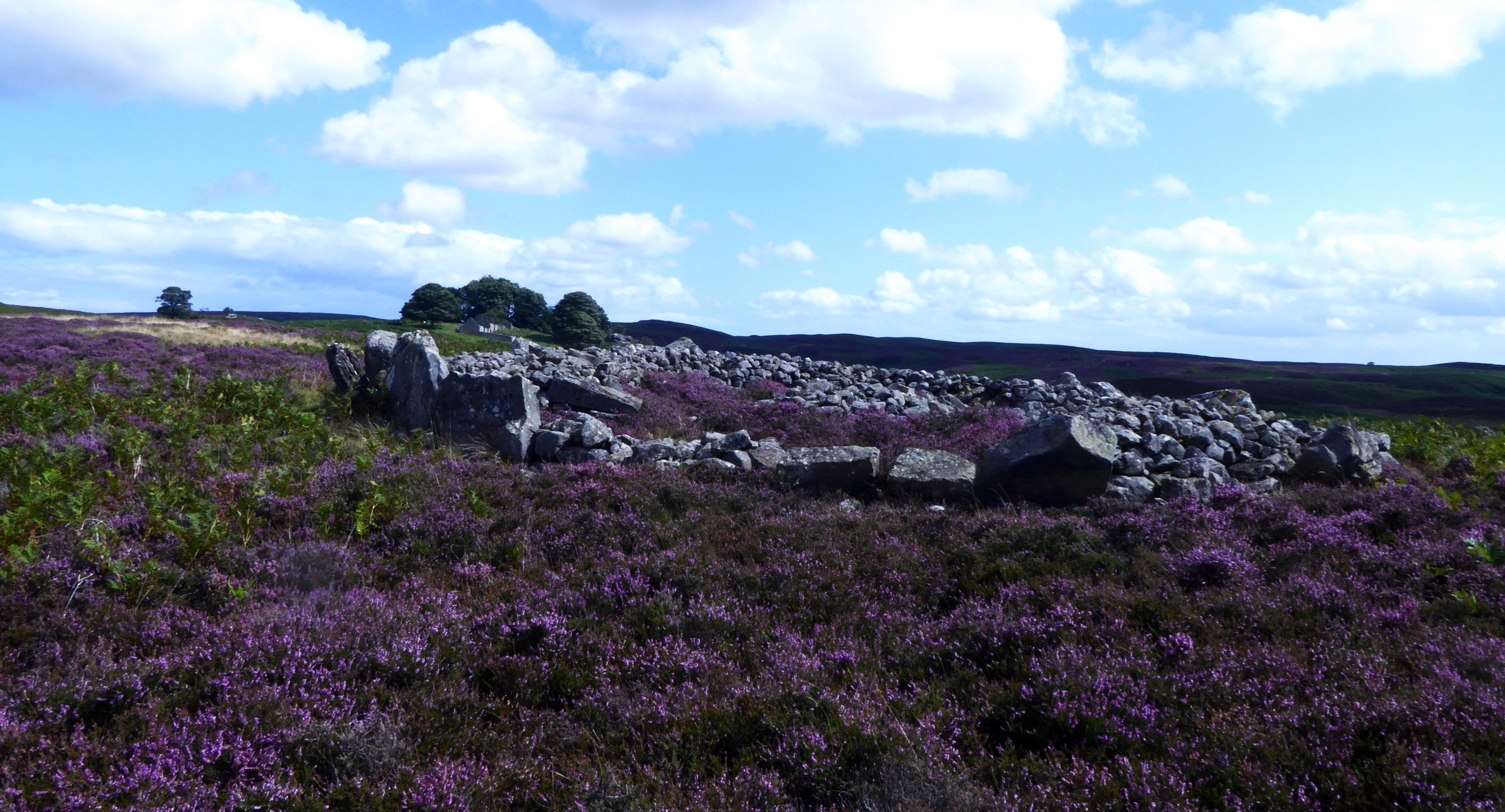
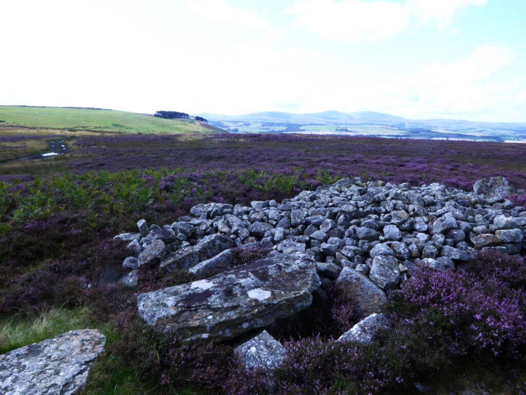
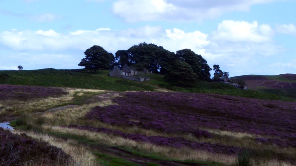
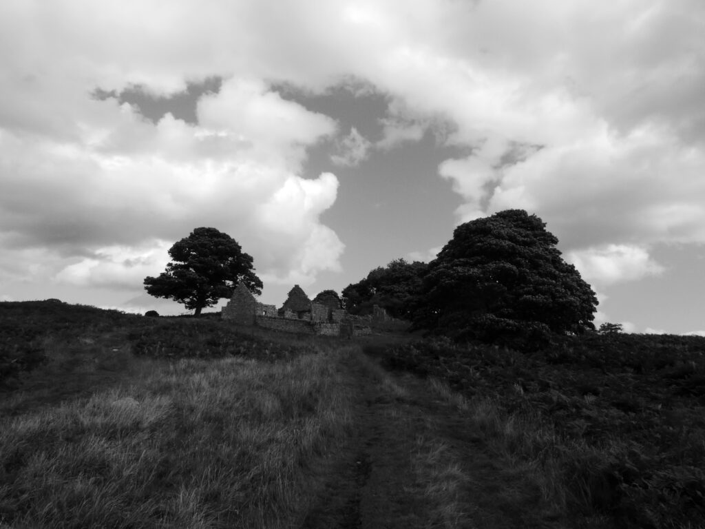
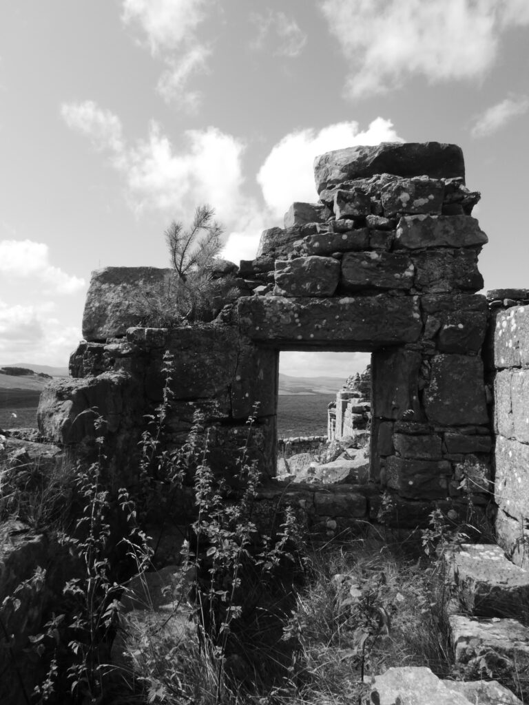
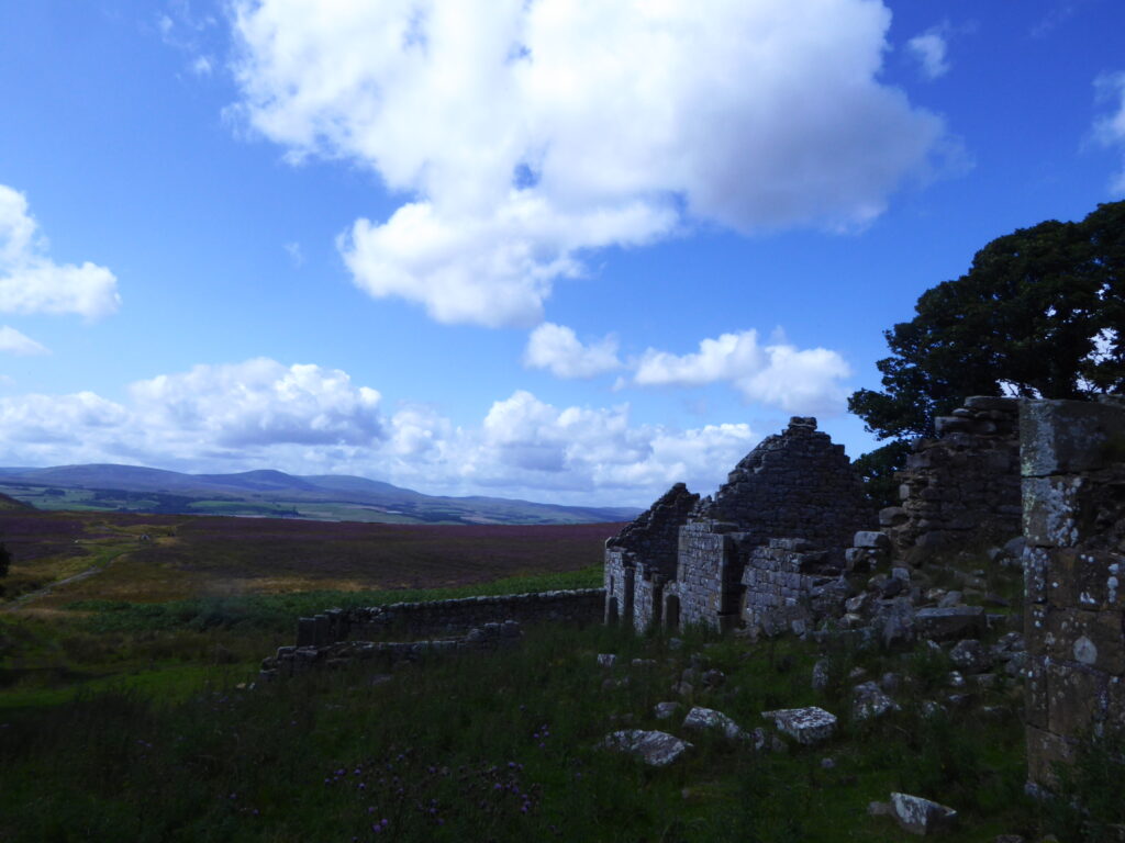
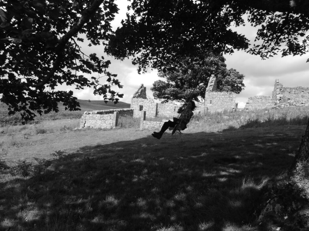
Returning to the main track up from the farm it starts to level out on to the wider moorland after the climb around the hill. The moors are quite an expansive area of near wilderness. Before long the ruined Blawearie (Weary of the wind!) Shepherd’s House comes into view straight ahead. Detour slightly off to the left of the track about quarter of a mile beforehand to see the stone burial cists amongst the heather there. I always find the vicinity peaceful, eerie and intriguing. A sense of awe at the expansiveness of the vista and wonderment if it was simply that same feeling which drove the ancients and the more recent inhabitants at the house to make settlements there. The house was requisitioned in WW2 and the family living there at the time chose not to return. Thereafter it fell into ruins. It’s a great location to explore and photograph in and around, sitting amongst mysterious and shadowy rock outcrops overhung with trees and bushes, some of the nearby trees strung with makeshift swings.
Various footpaths branch out across the moors. Heading south and not far from the Shepherd’s house ruin is Blawaerie Hillfort at NU 0875 2199 and the nearby Corbie and Greymare Crags. Roughly northeast and a bit further afield the Cateran Hole, a subterranean chamber which can be accessed on foot. I intend to describe this in a later blog post but with an approach from the Quarryhouse road across the moors from near Chillingham & Hepburn Woods and also taking in Ros Castle Hill.
Nearest options for post walk refreshment are the Tankerville Arms at Eglingham a bit further south from Old Bewick on the B6346 toward Alnwick or the Percy Arms back the way at Chatton.
Visitors to Honey Nuc will enjoy the peace and quiet of the immediate surroundings and can take gentle walks on the tracks around the surrounding farmland, occasionally abundant and colourful with wild flora and fauna. But only a couple of miles to the North the village of Belford is well placed as a good start point for longer walks/runs/cycle rides, and has various options for refreshment thereafter!
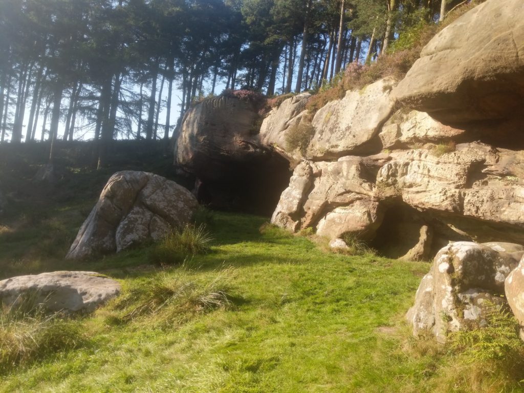
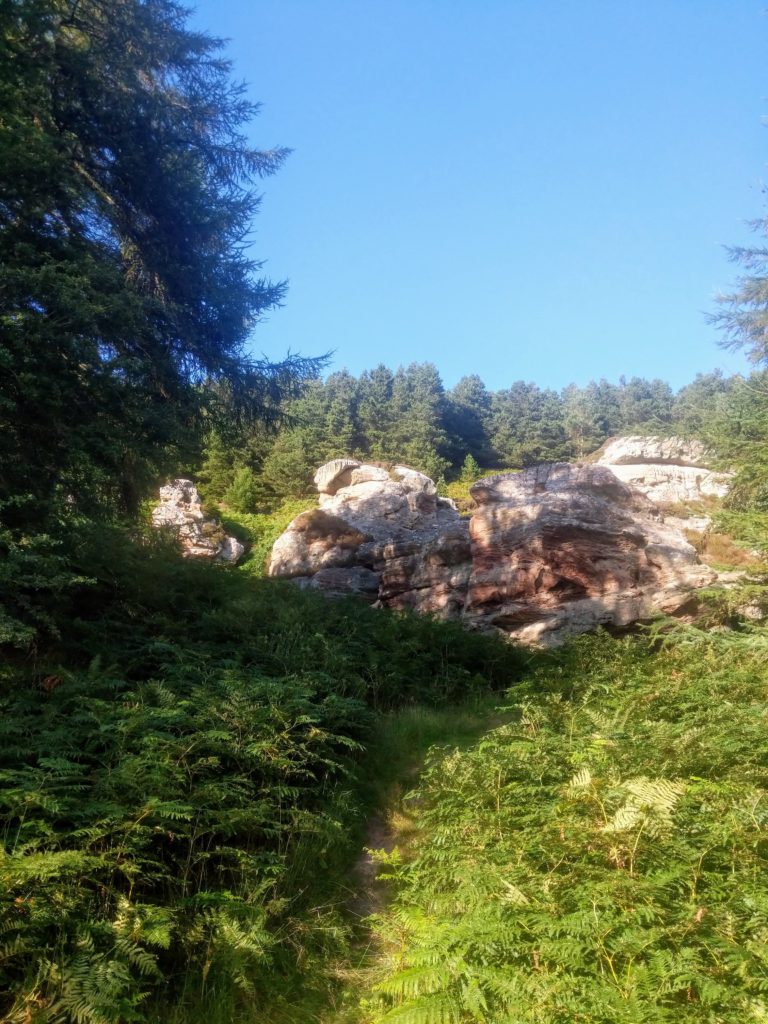
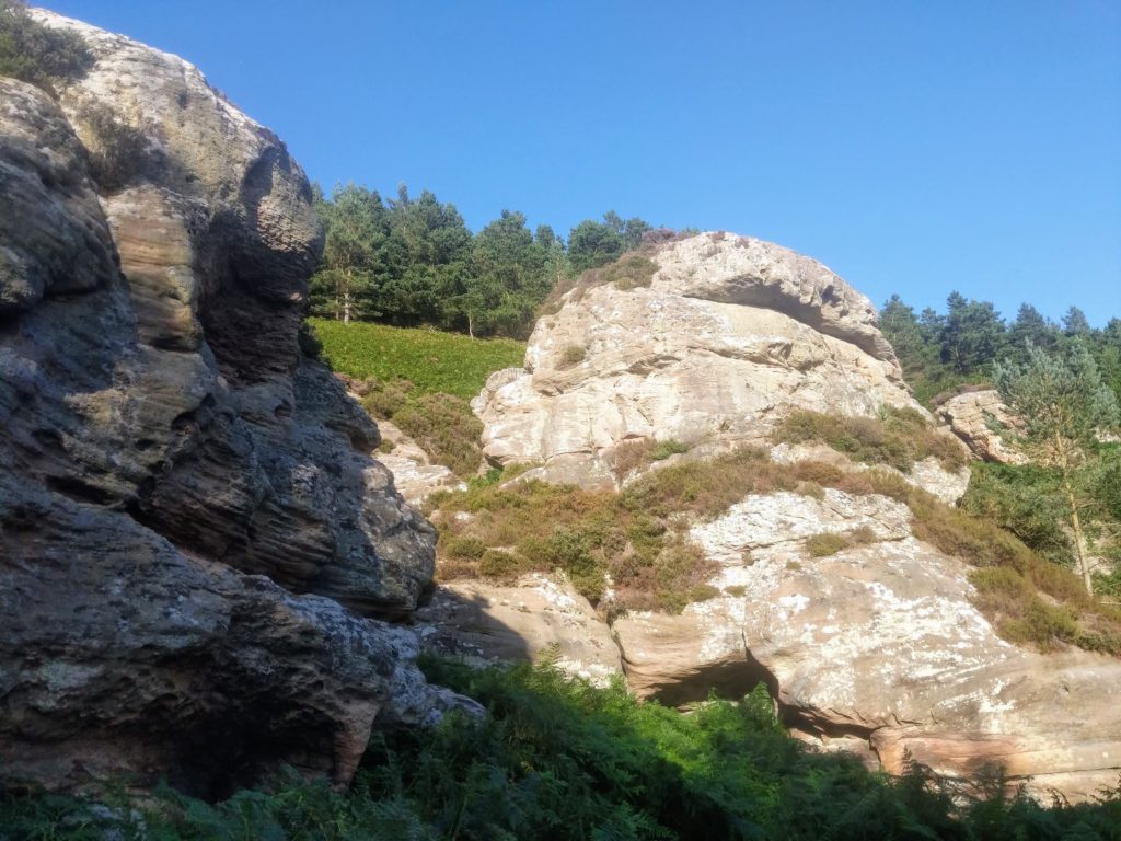
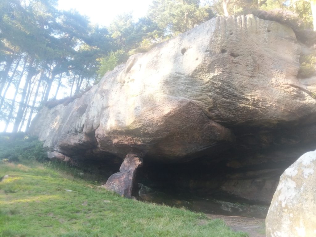
Here’s an outline of such a venture, a 10 mile country walk on tracks, paths and lanes. It’s a route I’ve used as a training run many times, which one of the local schools often followed for the annual sponsored walk, and which is also mostly rideable on mountain or cyclocross bikes although there are quite a lot of gateways. Nothing too strenuous, and great panoramic views along the way of the best of what Northumberland has to offer slightly further afield- the rolling Cheviots to the West and vast open coastline to the East. The highlight en-route, although not the literal high point, is the National Trust site of St Cuthbert’s Cave, (known locally as ‘Cuddy’s Cove’) a sandstone rock overhang/cave nestled in woodland, reputedly a temporary resting place for monks transporting the body of St. Cuthbert on fleeing Holy Island after Viking invasion circa AD875. The route can be shortened by starting at alternative points or short-cutting, and still taking in Cuddy’s Cove. I’ll mention these options in progression.
The War Memorial/ West Street Well/ Old abandoned Community Club NU 106 338 approximately half way up the built-up part of West Street (B6349 to Wooler, from Belford Mkt Sq) in Belford is your start point. There’s nearly always space to park right in front of the War Memorial. At the time of writing Belford’s sorry lack of a public village hall space has probably fuelled rumours that the desertion of formerly thriving venues which might serve the purpose, such as the Old Abandoned Community Club at the War Memorial or the boarded up Middle School, isn’t down to political and business ineptitude but rathermore due to hauntings! Such superstitions thrive in isolated rural communities. Fans of the paranormal and Scooby Doo alike will thrill to tales which circulate in the village of Country & Western tunes and the clinking of glasses from unidentifiable sources wafting across the streets. As well as the eerie early morning groans of schoolchildren being herded onto buses by mysterious forces and spirited away to far-off educational establishments.
Ponder such weirdness and offer respects to those killed in the wars, then begin your perambulatory escape from it all by taking the West Hall Lane immediately to the left of the War Memorial/ Abandoned Club.
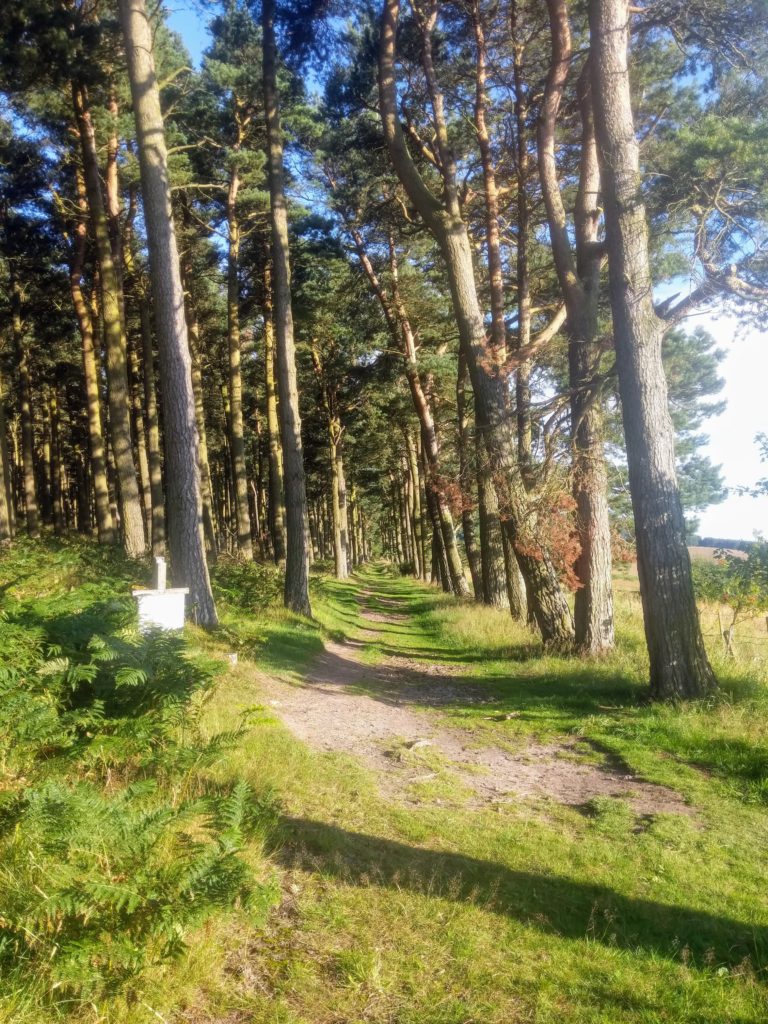
Crossing the Belford Burn you’ll soon come to West Hall Farm with its castellated fortress-like farmhouse to the left and wooded crags to the East. Follow the farm track between the steading buildings and farm cottages and on up the hill to Craggy Farm. Keep straight on through Craggy Farm steading and the metal gate with the old lime kiln just beyond to the right. There are several examples of such kilns dotted around the North Northumberland coastal area. Visitors to Honey Nuc may already have noticed a fine example on the approach road to the cottage shortly after turning off the A1. Following the track between the wall on the left and small crags to the right you’ll go through another metal farm gate, straight across a field and into Middleton Square Wood via a wooden gate.
The meandering path through the wood meets a track. Bear left and after about 100m continue straight on up the road which the track meets at the edge of the wood.
In about quarter of a mile where the road ends you’ll come to Swinhoe Farm NU 083 350 having covered about 2 miles.
Swinhoe could be an alternative start & finish point for the walk. Park respectfully by the cottages if doing so. The loop from there is about 6 miles. The return leg from Swinhoe to Belford on the longer route is simply the reverse of what I’ve described already or an alternative I’ll outline later.
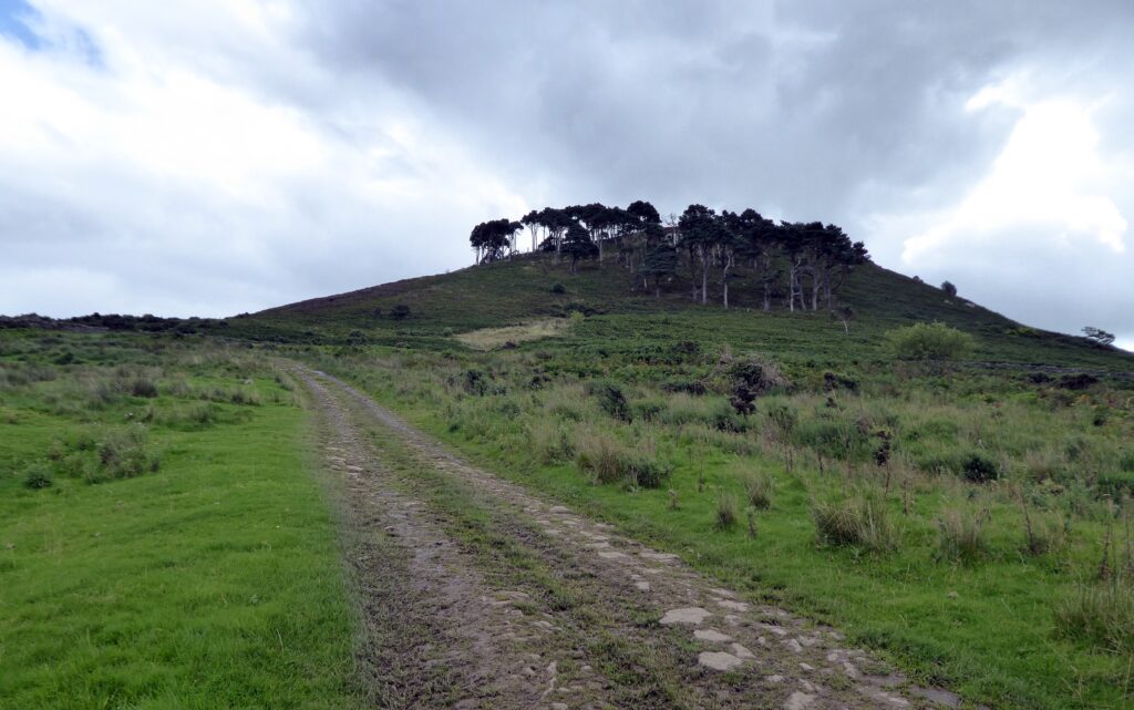
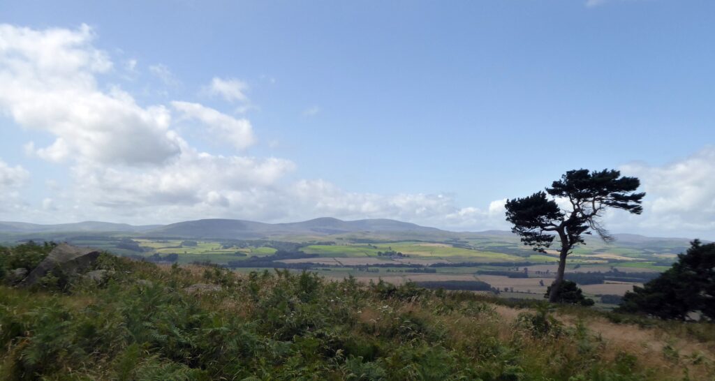
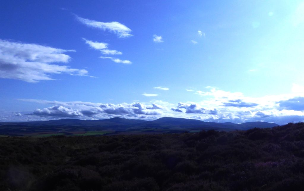
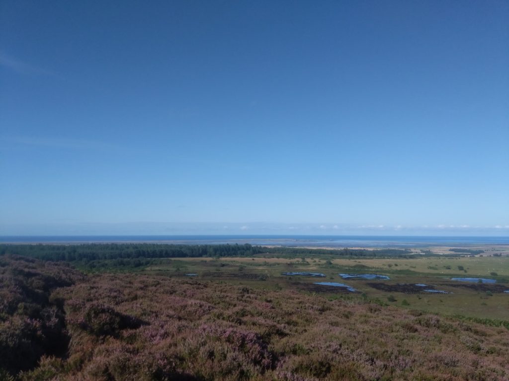
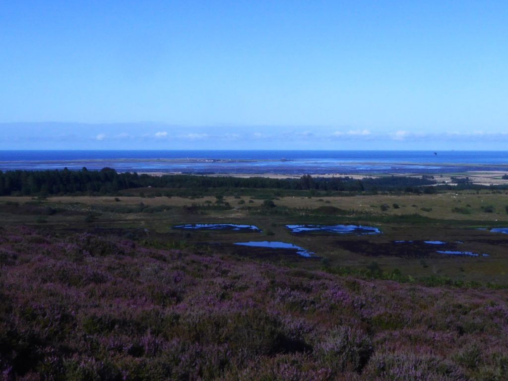
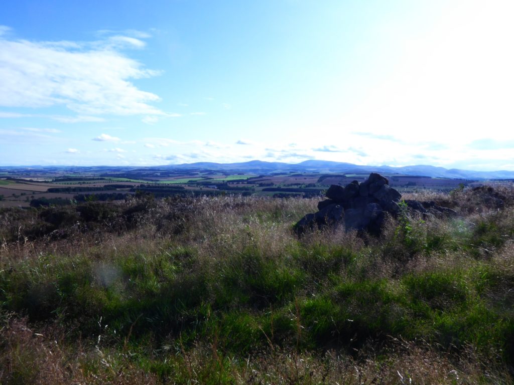
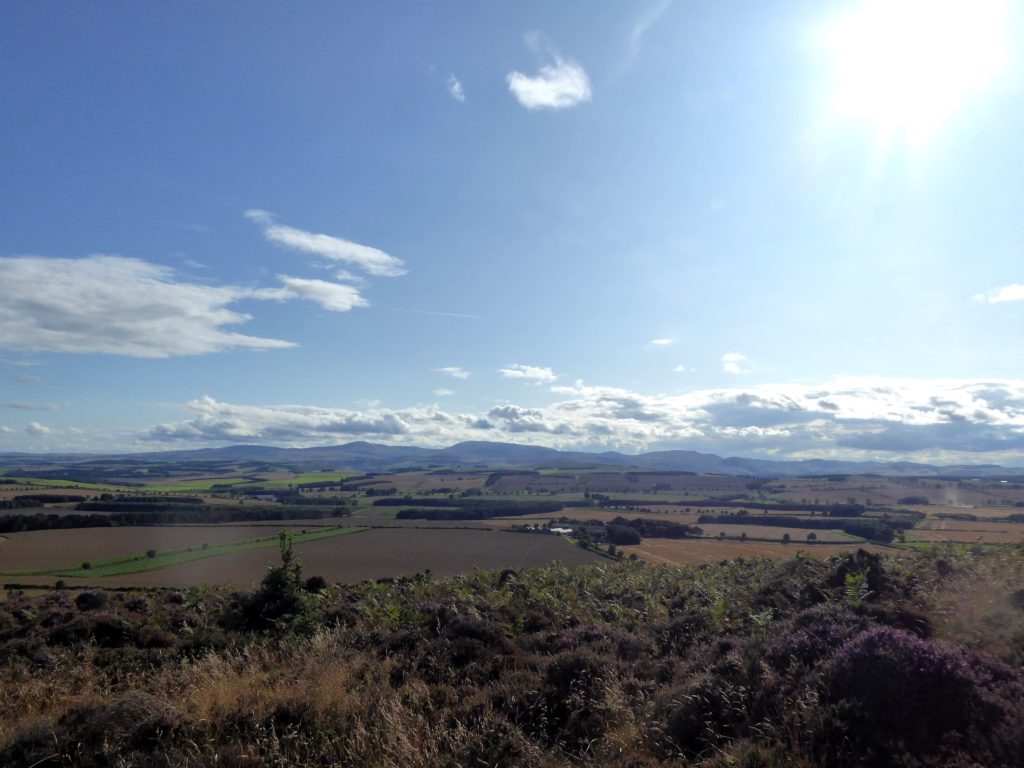
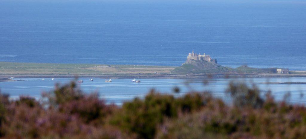
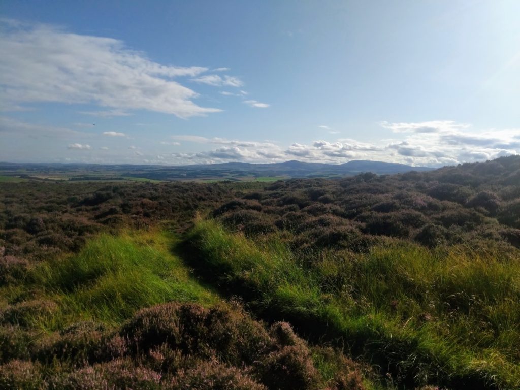
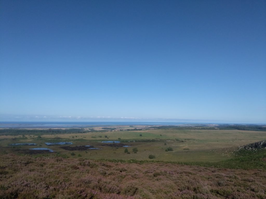
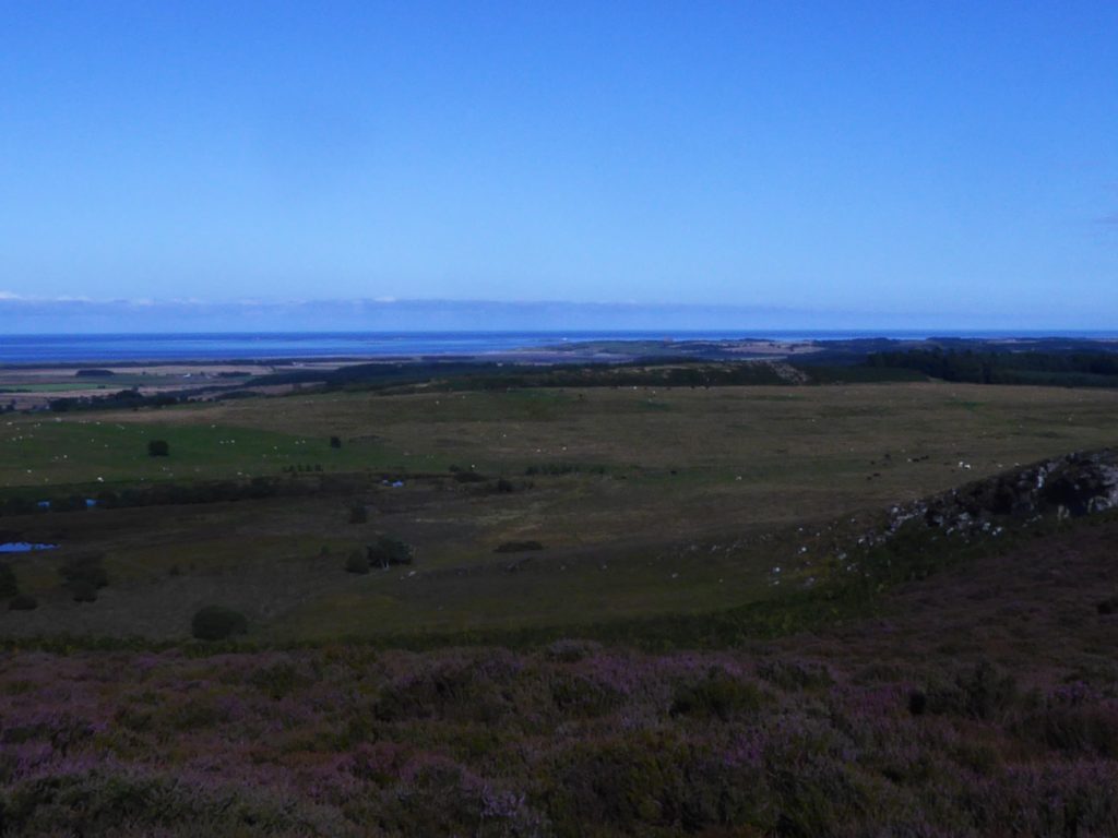
I’ll describe the loop anti-clockwise from Swinhoe. Take the track away from the farm that bears right, through the gate and towards the woodland ahead. The secluded and peaceful Swinhoe Lakes are tucked away just inside the woodland where the track begins to skirt the trees. A short climb up Virgin Hill and the track turns into the woods then comes out again onto open moors at a gate around about the 3 mile point. Keep the craggy outcrop which forms the top of Fawcett Hill to your right and the grass path brings you to a stile and track. At this point on a clear day you’ll have the first of magnificent views of the North Northumberland coast from Budle Bay, over Holy Island and all the way to Berwick. Also an option here to short cut the route by about 2.5 miles. Looking left/ West you’ll see Greensheen Hill over which the long route passes, and trees at the horizon which are the Eastern edge of the woodland in which Cuddy’s Cove is. If shortcutting then don’t cross the stile but rather head left across the moor on the grassy track heading for the point at the Northerly edge of the treeline/ Southerly end of Greensheen. The longer route comes to the same point later in its course and to continue on that then cross the stile, bear left on the track and follow through 2 gates as the track bears to the right and approaches Detchant/ Kyloe Woods with the pond to the right. As you enter Detchant/Kyloe Woods you’ll have covered about 4 miles and the next mile is simply keeping straight onward on the track through the woods, ie- ignore the right fork just after going into the trees. The track begins to descend and curve gradually through the woods, passes through a wooden gate, then descends a little more steeply and curves around the small Raven’s Crag to the right before exiting the trees at another wooden gate where you’ll start to get views of The Cheviot Hills. For about quarter of a mile the track is more grassy and undulating eventually coming to a small plantation and stone wall at the end of the Holburn track. Turn sharp left at this point, keep the wall to your right and follow the foothpath/sheep trod up the short steep incline through the gorse patches until you come to the wooden gate in the wall. You’ve started the climb of Greensheen Hill. The track after the gate flattens for a while and you’ll see another pond, the Gull Pond (Birdspotting!) to the left as it starts to climb again to Greensheen summit and trig point at about the 6 mile point. Fantastic views from here, even more expansive than before looking Eastward across the coast, Bamburgh and the Farnes now visible, and the Cheviots dominant to the West. Magical at sunrise or sunset!
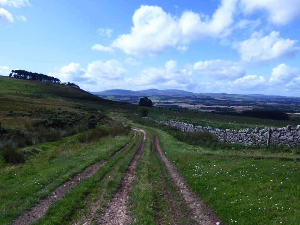
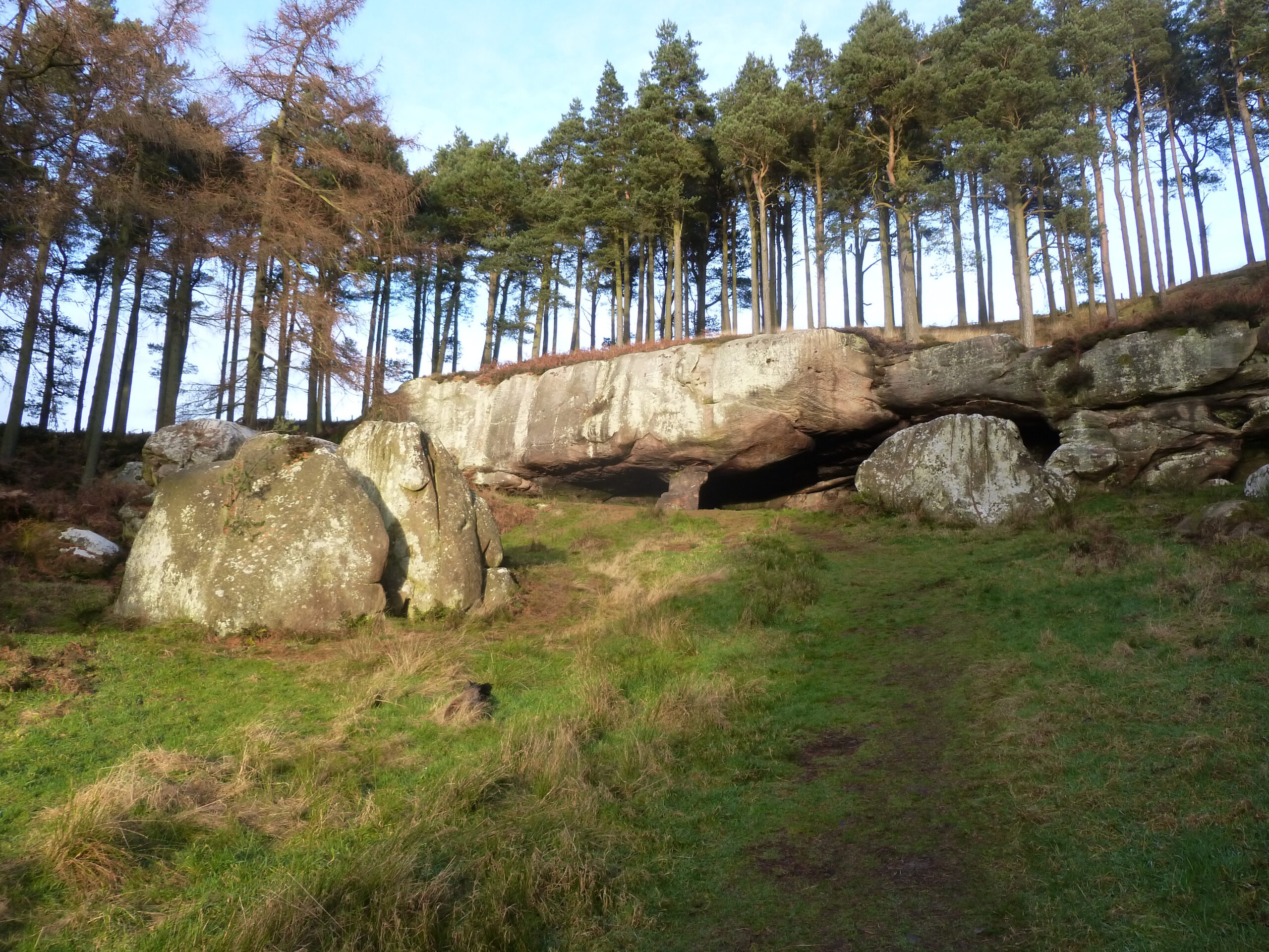
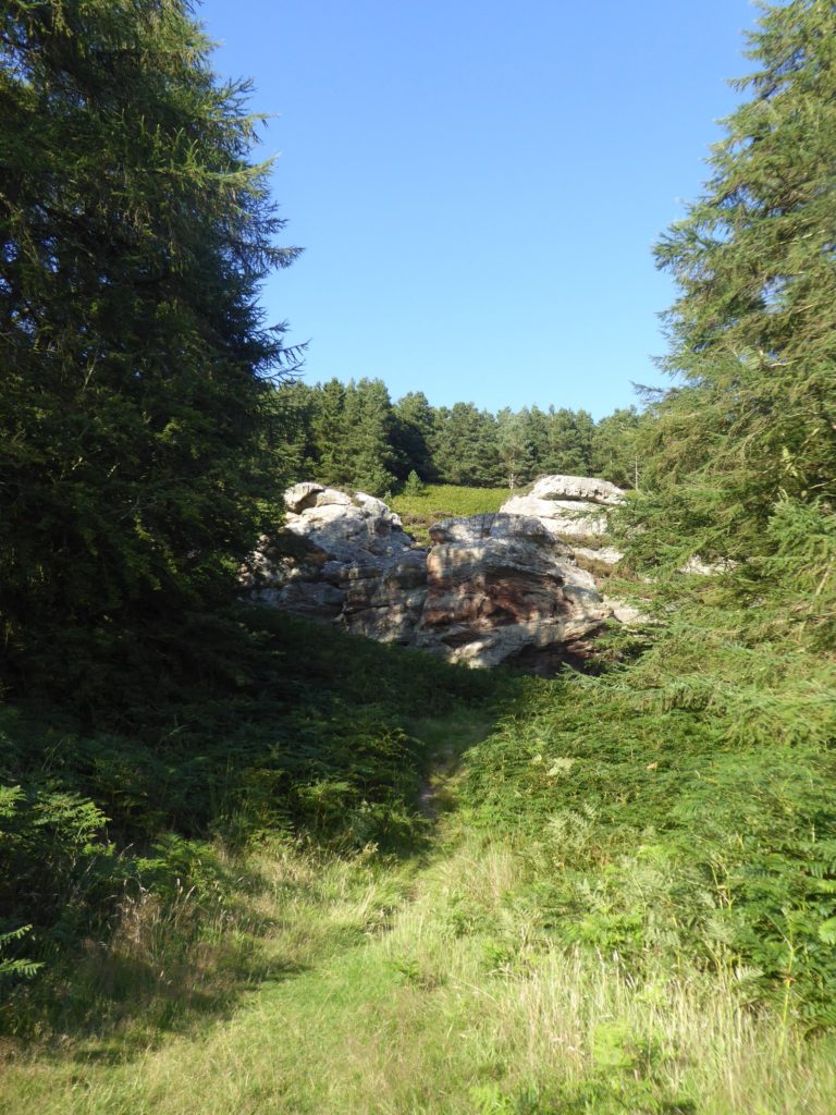
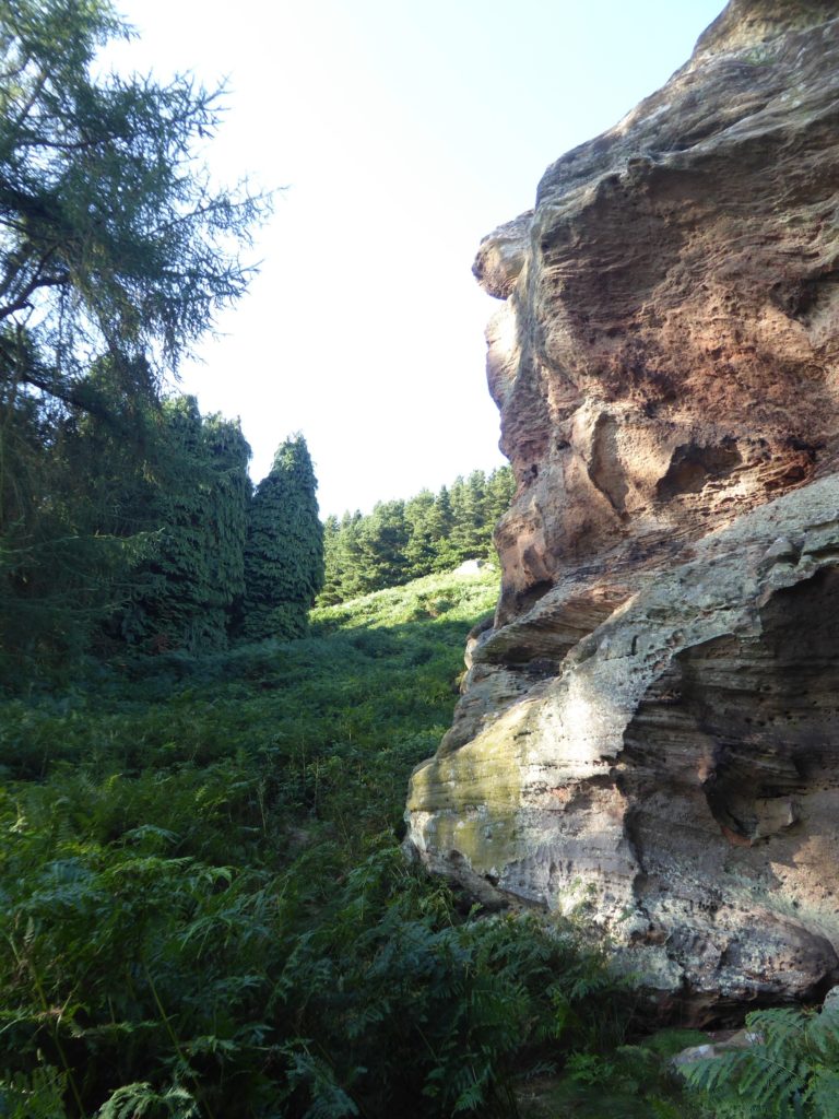
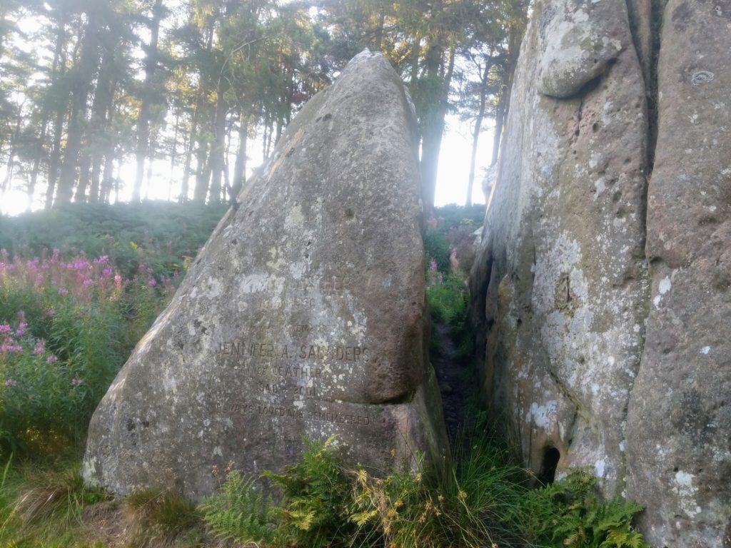
Straight on and downward from Greensheen summit the track narrows to a twisting and occasionally stony path through the heather and eventually comes to the edge of Cuddy’s Cove wood and the point previously mentioned if shortcutting. You can shortcut straight into the wood to the cave from here or descend its northern edge and meet the grassy path which approaches from Holburn Grange Farm. (Which is the closest point visitors to the Cave can drive to and walk from.) The path is at the West edge of the wood and Cuddy’s Cove obvious in a lovely West facing clearing on a branch from it. Enjoy exploring and clambering about the cave and surrounding rocks with care. Great spot for picnicking and sunbathing. Afterward keep straight onward on the grass path as it exits the wood at the other (more Southerly) end. There’ll be open fields to your right and the wooded Cockenheugh Hill to your left. Nestled under this flank of Cockenheugh and close by the track you’ll find other pillars/ towers of sandstone, same geological origin as Cuddy’s Cove, alternative places to climb, clamber and perch and admire the scenery. The track becomes a pathway passing within another section of woodland as it keeps skirting Cockenheugh, before exiting at a gateway, where it becomes a defined farm track, and descending at the edge of a field. Another gateway/stile at the bottom end of the field, then a dip and rise with the empty/ruined steadings of Dick’s Old Walls to the left. A descending section of hardcore track brings you back to Swinhoe Farm to retrace your earlier steps to Belford.
An alternative return to Belford from Swinhoe is to turn right between the cottages and steading/farmhouse and follow the public footpath skirting the field in front of the small hill with the telecomms mast atop. Keep on along the path following the ridge after the gate at the mast until you pass through another gate. Across the field to your right you’ll see Plantation Farm and closer by the wooded Juniper Hill. Keep Juniper Hill to your right and descend to the stone stile/wall at the Craggy Farm (over to the left) and West Hall Farm (ahead) boundary. Cross the stile and two fields with small wooded dene between, then turn left at the wicket gate and into the far end of the field where the castellated West Hall Farmhouse is. Follow the chattering Belford Burn amongst the trees and come out onto the West Hall Lane at another wicket gate just 50 yards from your start point.
Start
The War Memorial/ West Street Well/ Old abandoned Community Club approximately half way up the built-up part of West Street (B6349 to Wooler, from Belford Mkt Sq) in Belford is your start point. There’s nearly always space to park right in front of the War Memorial. Ponder such weirdness and offer respects to those killed in the wars, then begin your perambulatory escape from it all by taking the West Hall Lane immediately to the left of the War Memorial/ Abandoned Club.
Crossing the Belford Burn
Crossing the Belford Burn you’ll soon come to West Hall Farm with its castellated fortress-like farmhouse to the left and wooded crags to the East. Follow the farm track between the steading buildings and farm cottages and on up the hill to Craggy Farm. Keep straight on through Craggy Farm steading and the metal gate with the old lime kiln just beyond to the right.
Middleton Square Wood
Following the track between the wall on the left and small crags to the right you’ll go through another metal farm gate, straight across a field and into Middleton Square Wood via a wooden gate. The meandering path through the wood meets a track. Bear left and after about 100m continue straight on up the road which the track meets at the edge of the wood. In about quarter of a mile where the road ends you’ll come to Swinhoe Farm having covered about 2 miles.
Alternative start & finish
Swinhoe could be an alternative start & finish point for the walk. Park respectfully by the cottages if doing so. The loop from there is about 6 miles. The return leg from Swinhoe to Belford on the longer route is simply the reverse of what I’ve described already or an alternative I’ll outline later.
The Northumberland Sandstone Hills curve across central Northumberland in a series of distinctive flat-topped ridges which provide panoramic views of the Cheviots and the coast. The ridgetops and upper slopes are covered with heather and grass moorland broken by large geometric blocks of conifer. Below this is pasture with some arable cultivation on the lower and dip slopes, broadleaved woodland on scarp slopes and along watercourses and a few notable parklands. There is a long tradition of rearing hardy sheep and cattle in this area. A number of major rivers flow east to the coast: the Wansbeck and Font arise in the Sandstone Hills while the Aln and Coquet break through from the Cheviot Fringe. The Till meanders through the lowlands of the northwest corner of the National Character Area (NCA). The Till and Coquet are designated for their biodiversity value and are important game fisheries. The Sandstone Hills play an important role in the recharge of the Fell Sandstone Aquifer; the quality and availability of water in this NCA are important for the supply of water locally and to northern Northumberland, and there are opportunities to help to reduce flood risk in this and downstream NCAs.
This website uses cookies to improve your experience. We'll assume you're ok with this, but you can opt-out if you wish. Cookie settingsACCEPT
Privacy & Cookies Policy
Privacy Overview
This website uses cookies to improve your experience while you navigate through the website. Out of these cookies, the cookies that are categorized as necessary are stored on your browser as they are essential for the working of basic functionalities of the website. We also use third-party cookies that help us analyze and understand how you use this website. These cookies will be stored in your browser only with your consent. You also have the option to opt-out of these cookies. But opting out of some of these cookies may have an effect on your browsing experience.
Necessary cookies are absolutely essential for the website to function properly. This category only includes cookies that ensures basic functionalities and security features of the website. These cookies do not store any personal information.
Any cookies that may not be particularly necessary for the website to function and is used specifically to collect user personal data via analytics, ads, other embedded contents are termed as non-necessary cookies. It is mandatory to procure user consent prior to running these cookies on your website.