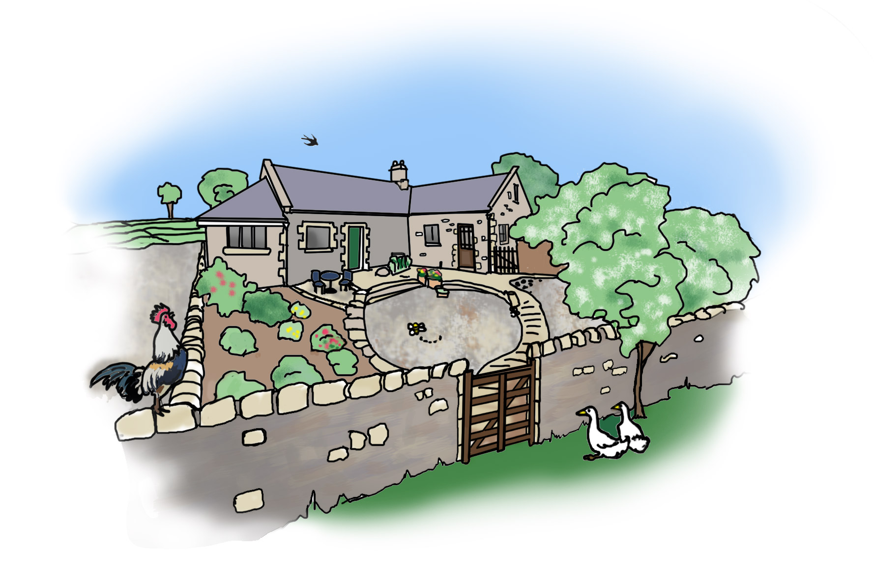
This is our Honey Nuc Blog page to inform you about all the good things that surround our beautiful cottage
Welcome to our new cottage in the country! we are officially up and running and looking forward to being the hostess with the mostest
We will be using this Blog page to offer up some very interesting information on things to see and do when visiting the Honey Nuc Cottage.
Northumberland is area of outstanding beauty and we will provide you with some information under our “Places of Interest” category
Hopefully some of the places you will never have heard of or even seen so please watch this space and share our blog with friends, pals, mates whatever and enjoy Northumberland
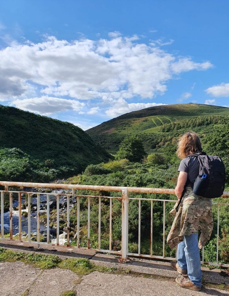
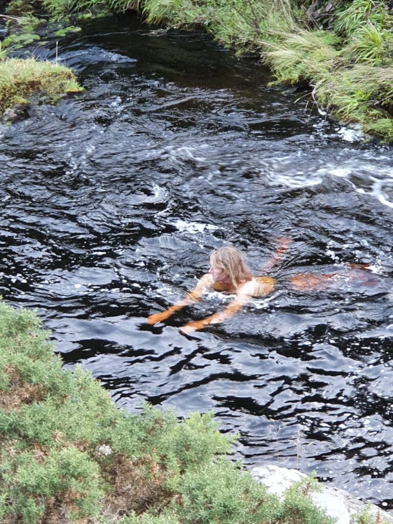
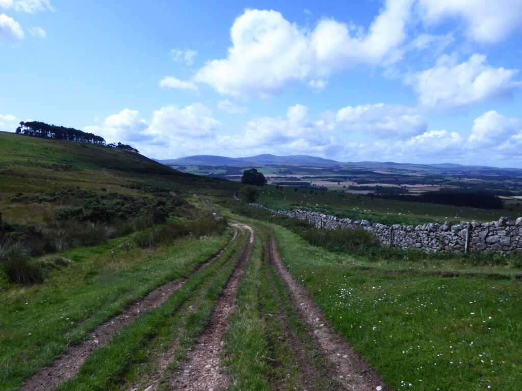
This is a lovely and relatively easy loop, for the most part, of a bit less than 5 miles, starting from the Carey Burn Bridge in the Harthope Valley, not far from Wooler. My friend and I walked the route on August Bank Holiday Monday between approx 15:30 and 17:30, in still conditions and delightful afternoon sunshine and, other than a few cars at the departure point when we set off, came across no other human activity. There’s the option for a bit of wild swimming towards or at the end of the walk in either the plunge pools below Carey Burn falls or under Carey Burn Bridge. Maybe think about taking a towel/ swimming gear. Some slight walking challenges in the last mile or so, sound walking shoes recommended.
If driving to the start point at Carey Burn Bridge (NT 976249) then, from central Wooler, go up Cheviot Street opposite the Coop and past The Anchor Inn (You can have fun devising tales as to why there’s a pub called The Anchor in a town with a distinct lack of boats, although none of those tales will be as tall as those about Red Lion pubs anywhere other than in Africa.) Take the first right about ¾ mile up Cheviot St and carry on about the same distance, passing through Yearle & Earle Farms at a bend, then on about another ¼ mile to Middleton Hall where you take a sharp right. This road takes you up a steep hill and past a farm at the crest, both called Skirl Naked, before dropping steeply again into the start of the Harthope Valley. At the bottom of Skirl Naked Hill you can park on the wide grassy verge to the right, just before the road crosses Carey Burn Bridge.
Starting the walk, cross the Carey Burn Bridge then take the signed footpath to Broadstruther immediately to the right by the farm shed. This climbs quite steeply at first, up the side of Snear Hill and past a pine plantation on the left. It’s worth a mention at this point that in some parts of the surrounding hills, what were once much smaller footpaths and ‘trods’ have evolved (With the use of quad bikes for shepherding and the expansion of land management for game bird shooting.) into broader tracks. This is the case with the first half of this route. The ‘footpath’ is at first a hardcore track and then a quad track for most of the way to Broadstruther. It doesn’t at all detract from the beauty of the surroundings and makes for easier wayfinding to an extent, although my friend and I, using a rather dated map, were head-scratching at a couple of points because some previously used paths marked on maps are slowly being obscured as walkers use the newer and more obvious routes which don’t always follow exactly the same course! Little direction is needed though. Keep on the most obvious track when you come to a gate after the climb. As it gently descends there’s a small copse of trees on the left hand side of the next hill that the route skirts. Before long you come to a track junction. (NT 948249)
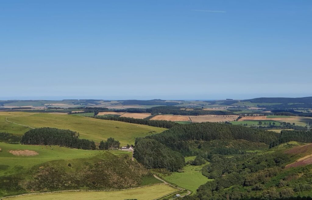
Across the decline of Hazelly Burn and the open moor in front you can see Broadstruther, for a long time nothing but a weather-beaten ruin, but now a renovated and spruced up dwelling sitting in solitary splendour amidst the breathless nothingness. On a nice day that is! Seasoned fell runners familiar with the area might also be breathless at Broadstruther, it being the first of several checkpoints on the region’s most renowned and long running race, The Chevy Chase, a 20m loop from Wooler YHA taking in Cheviot and Hedgehope summit- and most of the remainder of this walk route but in the opposite direction. This track junction point is a good example of where deterioration of the original footpath has occurred though because formerly the trod to Broadstruther would’ve gone in near enough a straight line across Hazelly Burn and the moor to the buildings. Now that route has been all but obscured as most traffic, on foot or otherwise, takes the right turn at the junction, dipping into the Hazelly Burn ‘valley’ and follows the track. Following said track and going so far as Broadstruther itself would add about ½ to ¾ mile on the overall route distance first mentioned and it’s just an out and back section from the Hazelly Burn crossing. That crossing is a wooden footbridge near some stone sheepfolds a little further down the track after bearing right at the junction. The track goes through a ford. My friend and I didn’t extend to Broadstruther, instead turning near the confluence of Hazelly Burn becoming Broadstruther Burn at a second wooden footbridge a little further ahead and visible from the one over Hazelly Burn.
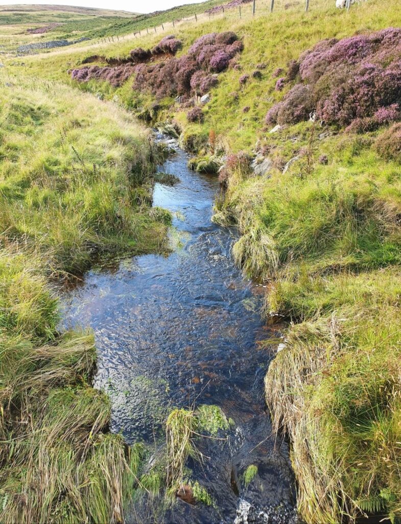
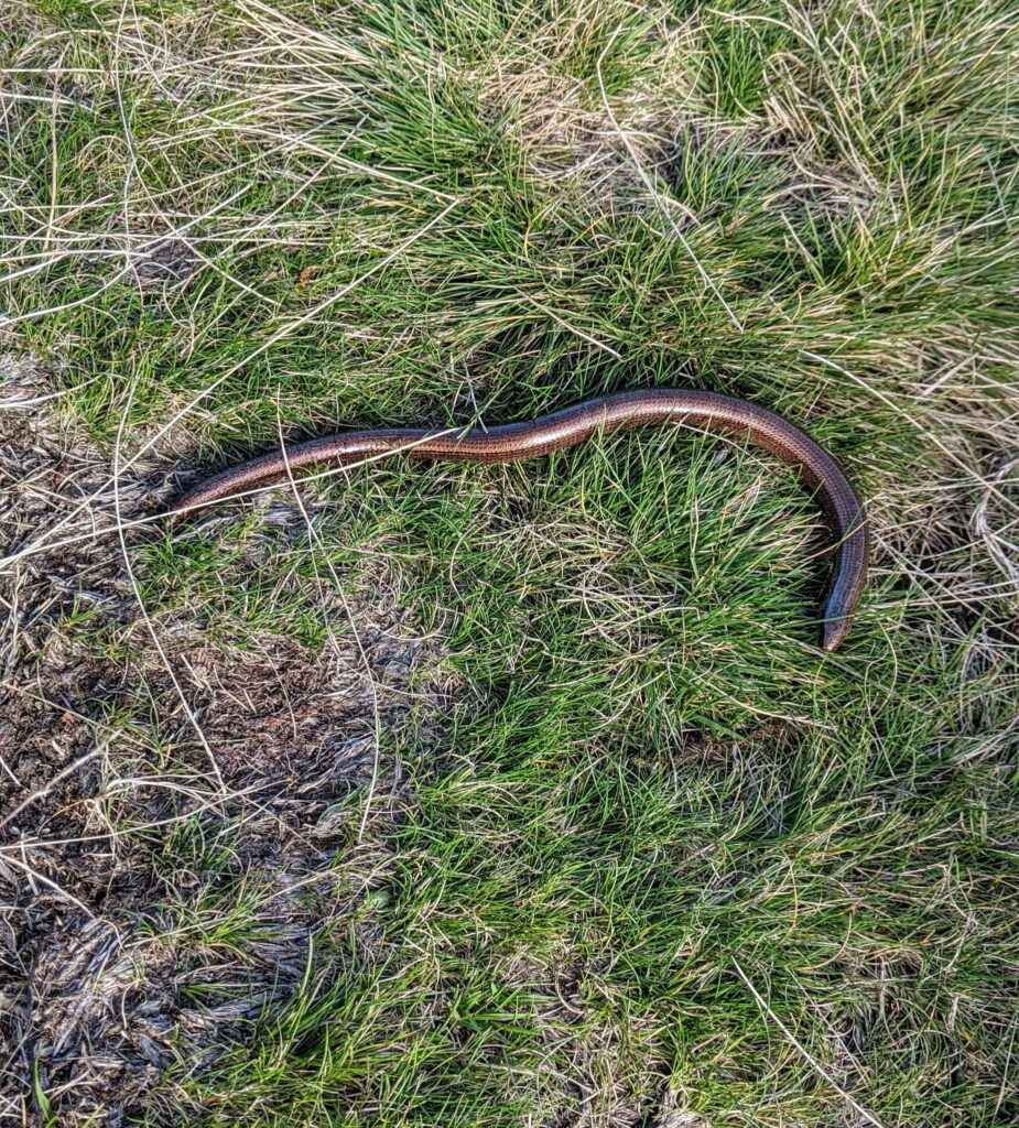
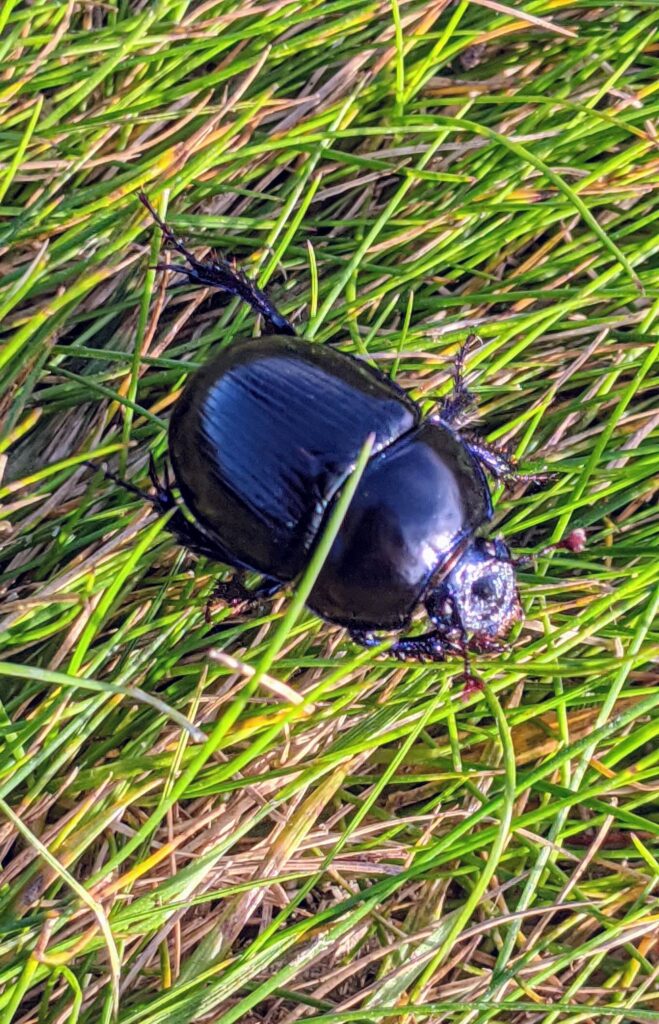
Thereafter a lovely stretch of footpath follows the course of the Broadstruther Burn valley downstream, with the burn to the right. The path passes through an area of small rowans which were aflame with berries, and a growth of well established broom bushes which I imagine would look amazing when in bloom. We saw a slow-worm basking on the path and numerous big black beetles scurrying. The grassy path descends to the confluence of Broadstruther Burn becoming Carey Burn and crosses another wooden footbridge at a pine plantation. A little further on keep bearing right with the Carey Burn immediately to your right rather than heading up the hill on the path between the trees.
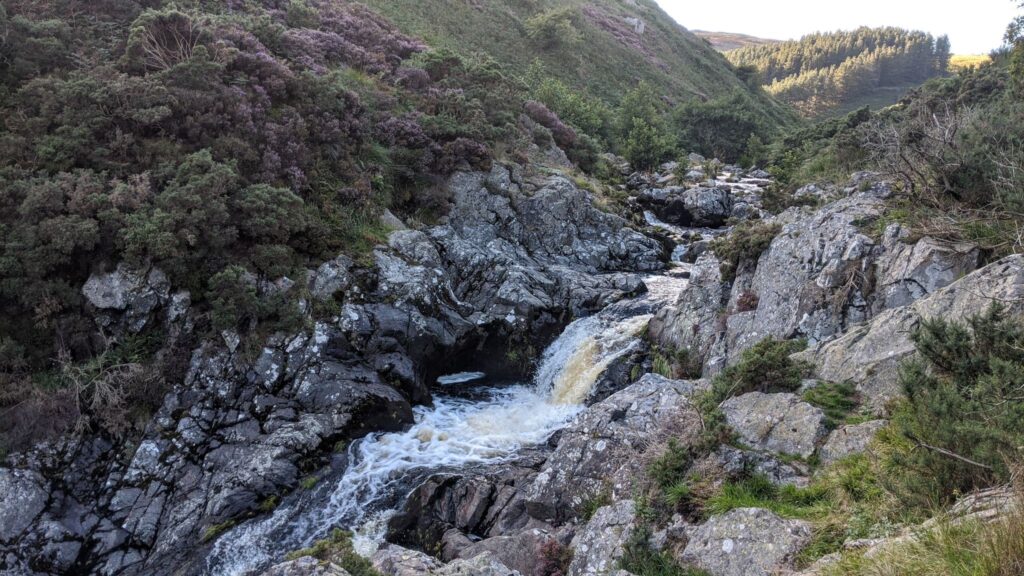
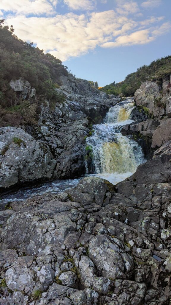
This last stretch of the looping route, within the Carey Burn Valley and down to the bridge again, is a joy, although not without minor challenges. It’s simply a matter of following the path downstream, keeping the burn to your right. The first part of the way, exiting the area bordered by the pines, can be a bit squishy underfoot. Thereafter, approaching and in the area of the waterfalls, the track is closer to the water and involves a little clamber here and there on some stony sections and caution where it is narrow. Part of the way also passes through some gorse, perhaps a little more grown-in over the path than usual this year with reduced footfall. Further downstream from the falls there is another stony section with skree from the valley side littering the path. These are all obstacles quite easily navigable with care and attention though and well worth it for a pause to admire the falls en route which cascade about 20m within a small rocky gorge. I couldn’t resist a quick dip in one of the pools beneath to cool off and freshen up. Further downstream as the valley widens the path becomes grassy and easy going for the last stretch toward Carey Burn Bridge again.
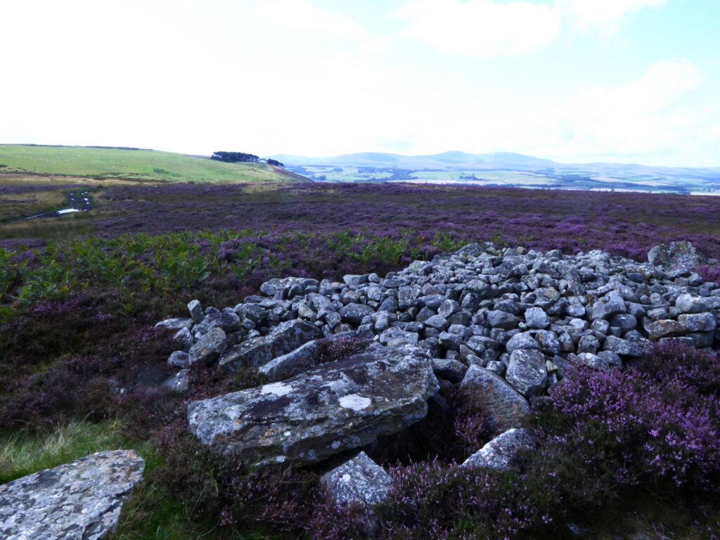
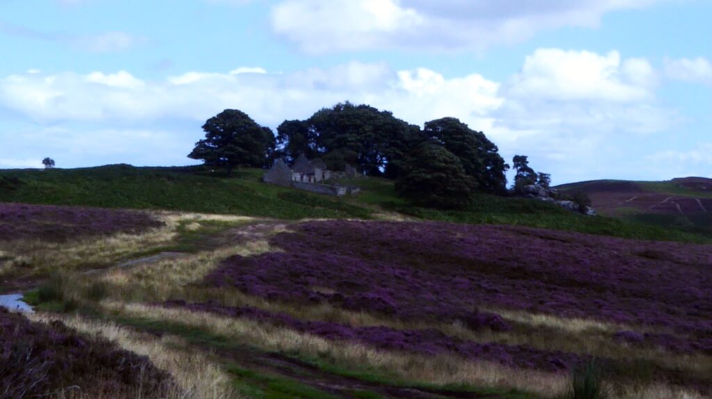
This short out and back walk of about 2.5 miles involves a modest climb on track and footpath leading to a ruined shepherd’s house with an Iron Age hillfort and burial cists en route. The walk could be extended to further explore the open moorland beyond the ruin and other points of interest which I’ll mention.
Start point is Old Bewick Farm, about 20mins drive from Honey Nuc. Take the A1 south and then first right after about quarter of a mile onto the B6348 for Chatton. When you’re almost through Chatton village take a left heading south on the B6346 toward Alnwick. You’ll pass through Chillingham on this road and after approximately another 3miles and a series of bends in the road at the crest of a hill reach Old Bewick Farm at the left hand side of the road. Postcode NE66 4DZ and Grid Ref NU 0666 2150.
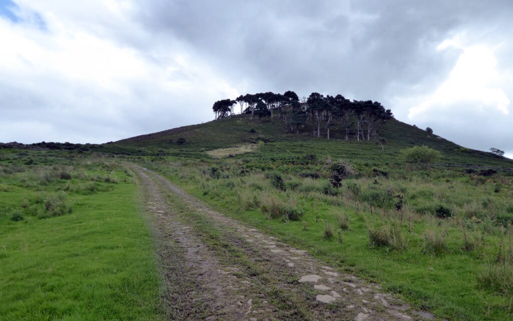
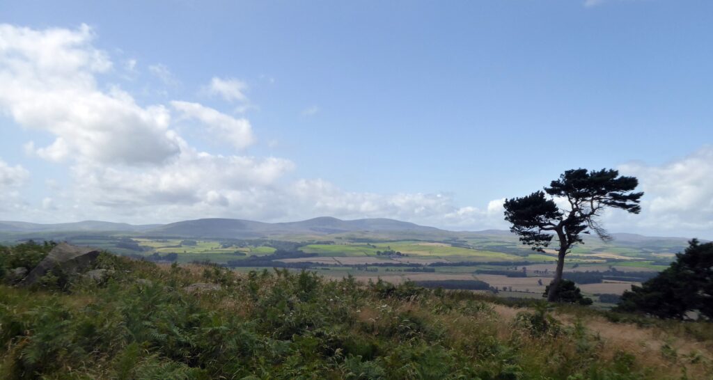
Park with consideration on the verges by the farm buildings at the roadside. Start the walk by keeping to the track closest to the farm cottages. You’ll see Bewick Hill and Hanging Crag with Scots Pine trees overlooking the farm to the right. Old Bewick Hillfort is atop the hill to the right side of the crags. From the gateway at the foot of the hill there is supposedly a footpath which branches from the track, contours the hill and comes to the hillfort. My friend and I found that this petered out and was overgrown with bracken. We backtracked, continued up the track toward the back of the hill then bore off to the right and approached the hilltop via the small rectangular plantation of trees there. Atop Hanging Crag gives a splendid view of the Cheviot Hills. The Iron Age hillfort is a series of raised earthworks. There are more recent fortifications in the form of WW2 pillboxes and cup and ring rock markings on nearby freestanding boulders.
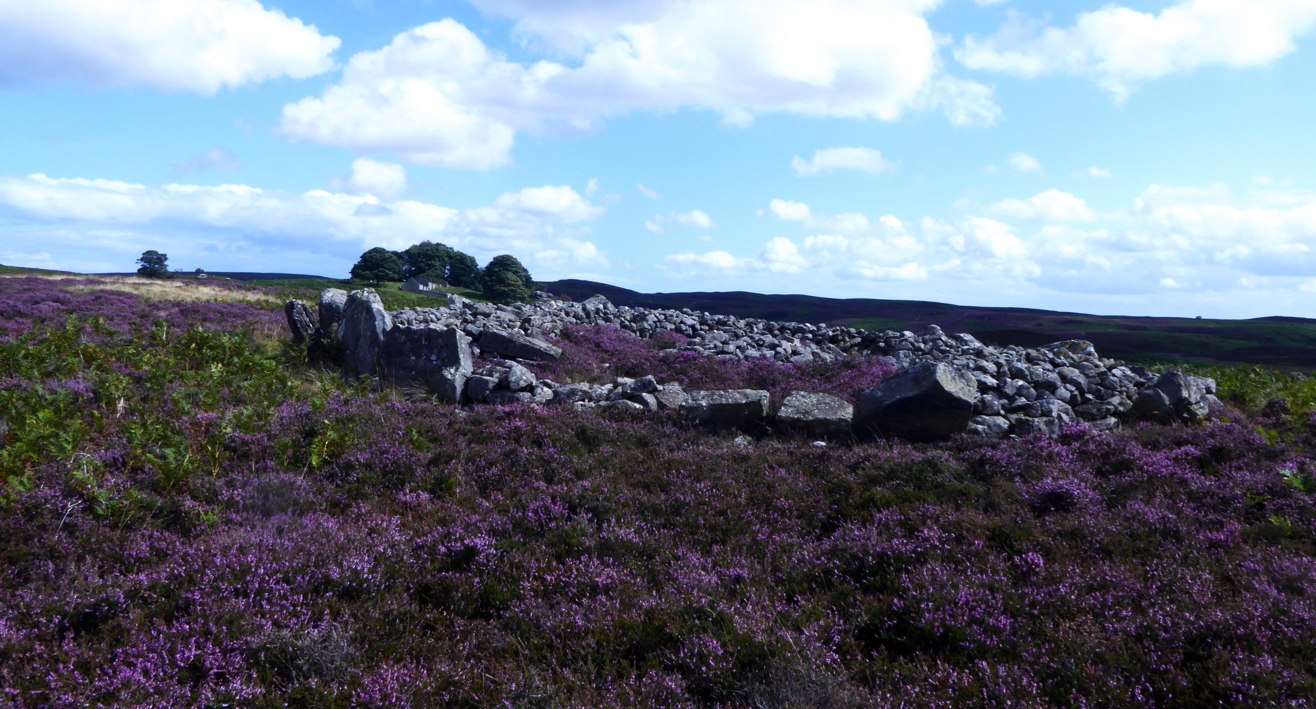
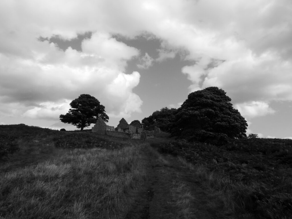
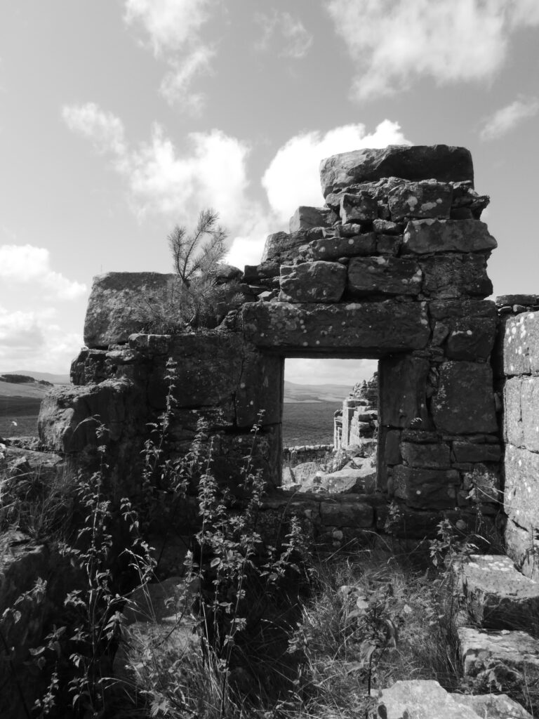
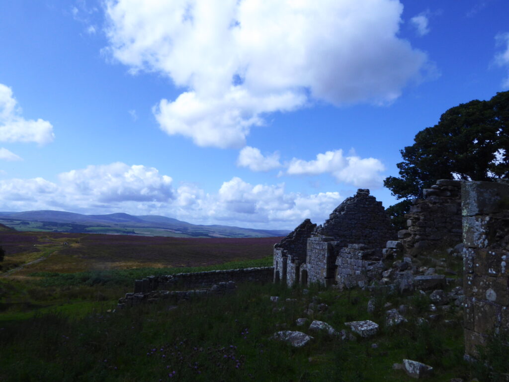
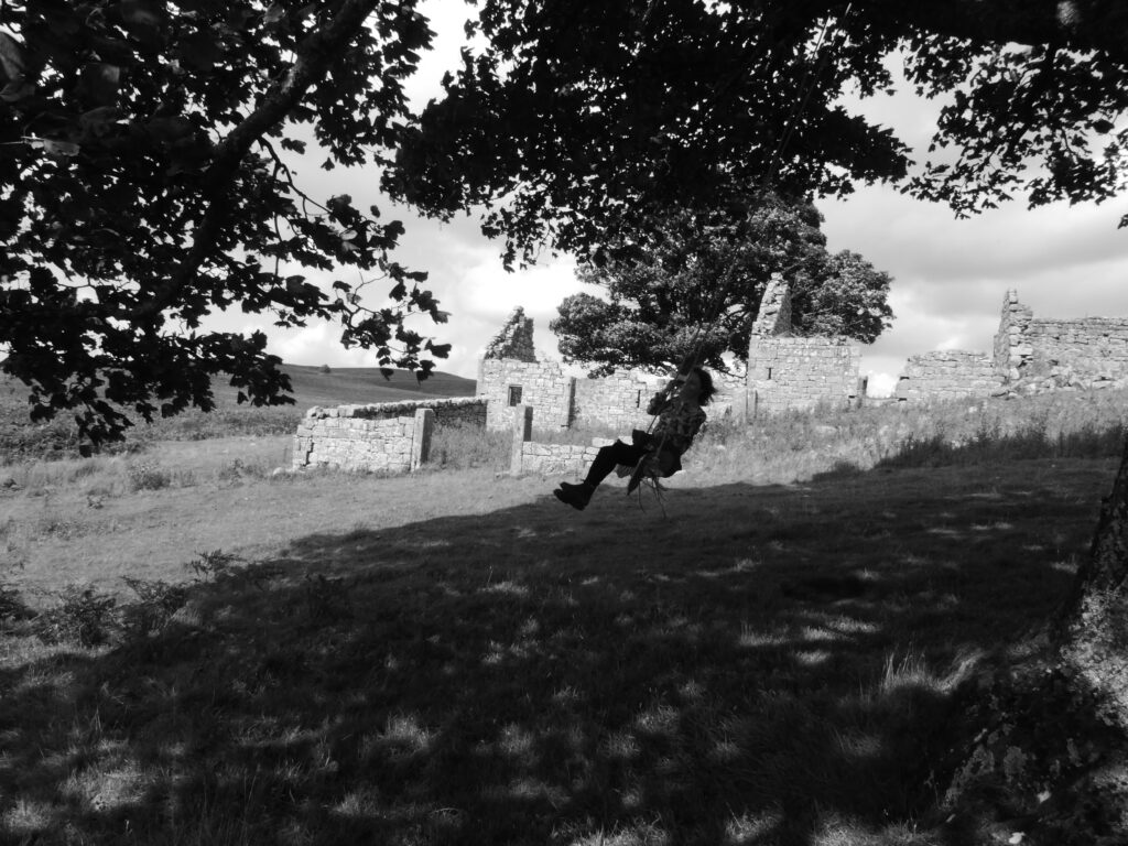
Returning to the main track up from the farm it starts to level out on to the wider moorland after the climb around the hill. The moors are quite an expansive area of near wilderness. Before long the ruined Blawearie (Weary of the wind!) Shepherd’s House comes into view straight ahead. Detour slightly off to the left of the track about quarter of a mile beforehand to see the stone burial cists amongst the heather there. I always find the vicinity peaceful, eerie and intriguing. A sense of awe at the expansiveness of the vista and wonderment if it was simply that same feeling which drove the ancients and the more recent inhabitants at the house to make settlements there. The house was requisitioned in WW2 and the family living there at the time chose not to return. Thereafter it fell into ruins. It’s a great location to explore and photograph in and around, sitting amongst mysterious and shadowy rock outcrops overhung with trees and bushes, some of the nearby trees strung with makeshift swings.
Various footpaths branch out across the moors. Heading south and not far from the Shepherd’s house ruin is Blawaerie Hillfort at NU 0875 2199 and the nearby Corbie and Greymare Crags. Roughly northeast and a bit further afield the Cateran Hole, a subterranean chamber which can be accessed on foot. I intend to describe this in a later blog post but with an approach from the Quarryhouse road across the moors from near Chillingham & Hepburn Woods and also taking in Ros Castle Hill.
Nearest options for post walk refreshment are the Tankerville Arms at Eglingham a bit further south from Old Bewick on the B6346 toward Alnwick or the Percy Arms back the way at Chatton.
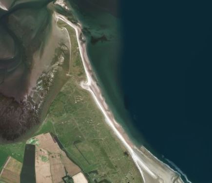
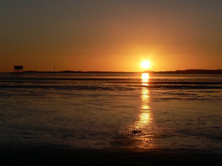
Should your stricken conscience (If it is so) need some respite from ceaseless images in the media of plastic strewn seas and beaches then there’s no better place to visit, at the time of writing that is, than Ross Beach. Ross is one of Northumberland’s most vast and quietest beaches and a walk along the unspoiled sands to The Beacons at the northernmost point provides a good objective if you’re in the mood for more than simply relaxing at the seaside. You might see a washed up lobster pot, net float or fish box as you wander but why not carry a bag anyway and pick up any smaller litter that you do find? Honey Nuc likes to support the ethos of 2 Minute Beach Clean. https://beachclean.net/
Perhaps the main reason for Ross being particularly crowd free is that there’s a walk of about a mile to the beach from the closest point (Ross Farm) at which you can park a car. I think it’s OK to cycle across the links between the farm and dune fringes of the beach. Certainly was when I was a lad. And you could lock bike/s to a fence amongst the dunes near the beach. The walk I’ll describe is a bit over 10km, 6.3m, and is out and back for the most part but with a loop section around midway.
Ross Farm (Belford NE70 7EN Grid Ref NU 133372) is about 6 miles from Honey Nuc by road. Take the A1 north, turn off right onto the un-named road at the junction opposite Belford Quarry, (This being the second junction off the A1 as you head N from Adderstone Mains road end.) cross the railway at Crag Mill crossing then turn left, carry on for about ¾ of a mile and take the first right which leads to Ross Farm. You’ll come to a point with signs indicating you can’t drive any further. Park there on verges to the left of the road and don stout walking shoes. Or trainers. Or even sandals. You shouldn’t have been driving without shoes on!
Walk straight along the road beside where parked, past the various cottages of Ross Farm and through the gate at the brick built Coastguard Cottages where Ross Links begin. Keep on the track and then hardcore path which becomes grassy as you approach the dunes. Through another smaller gate in the fence amongst the dunes and you’ll soon be at the sands where you’ll be met with a huge coastal vista of Ross Back Sands and Budle Bay bookended away to the north and south by Lindisfarne and Bamburgh Castles respectively. Quite a sight here if the North Sea (The area of sea just off the sands is called Skate Road) is broiling with a big swell, and on a day with millpond calm the sense of space and peace is uplifting. Dogs and small children alike are liable to flip into a frenzy of excitement trying to fill the emptiness.
Look northward along the beach and you’ll see the twin peaks of The Beacons just beyond the far dunes and across the water from Holy Island. About 2/3rds of the way along the sands to the north is an inlet between Ross dunes and those which form a small islet, Old Law, beyond and where The Beacons are. The inlet is called the Wide Opens and on big full tides it can flood with water through to Fenham Flats to the rear. Wide Opens doesn’t flood with much water when it does but keep the possibility in mind with the timing of your walk if you’re going all the way to The Beacons. Another possible obstruction to walking all the way to The Beacons, usually beyond Wide Opens, is the ground nesting of some seabirds during some of the Summer months. English Nature post signage about this restriction at Ross and on the beach as well as sometimes having wardens patrolling the beach to alert people.
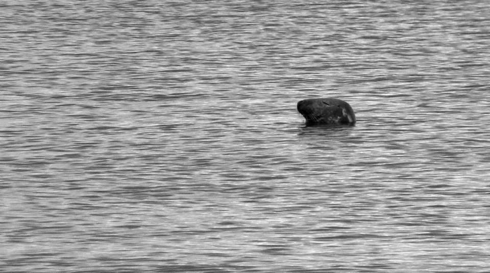
Once at the beach your walk is simply heading northward on the beach until you come to Guile Point where the Beacons are. The Beacons are called Guile Point (The eastely one) and Heugh Hill (Westerly) or sometimes Guile Point East & West, Old Law, and are described by Trinity House as wooden interior, stone clad obelisks, established in 1826. They are 21m and 24m high respectively, solar powered lights were added in the early 1990’s and they mark safe passage for vessels approaching Holy Island Harbour. Guile Point is a good place for watching seals which are often swimming close by shore in the waters there. When I last visited a colony of them was basking on the sands at the point.
Rounding the point you can continue on the landward side of Old Law until you come to Wide Opens again and cut through there back to the beach. On the landward side of Old Law you’ll look across Fenham Flats toward the mainland. The whole area of the flats fills up at toward high tide and this flooded area is what isolates Holy Island twice a day. Fenham Flats is also the location of the oyster beds of the highly respected Lindisfarne Oysters based at Ross Farm. There’s a lovely area of the high water mark on this landward side of Old Law where broken seashells have encrusted the sand/mud tideline to form a natural mosaic pathway.
Once you’ve rounded Old Law and cut back through Wide Opens to the beach the return leg of the route is simply to retrace your steps back along the beach and across the dunes and links to Ross Farm again. You could extend a little by going as far south on Ross Back Sands as you wish. The beach becomes the inlet of Budle Bay at the southerly, Links End, point. Budle Bay also floods with the tide incoming toward full.
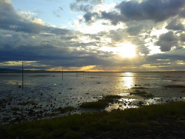
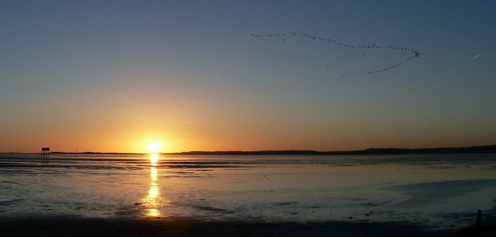
The Holy Island Of Lindisfarne, quickly accessible from mainland Northumberland via the approach road off the A1 at Beal and then across the causeway at low tide, is a very popular destination for visitors to Northumberland. Perhaps it’s become something of a ‘must do’ destination which is hardly surprising considering its unusual location, natural beauty, wealth of places to visit and early Christian and Viking history. Nearly all visitors travel there by car, many by bike and, especially around Easter time, numbers of folk make the traditional pilgrimage across the sands beside the causeway on foot following the Pilgrim’s Way, a line of tall wooden poles marking the shortest route. The island is at the start/end of the St Cuthbert’s Way, Melrose in the Borders being the other extreme, another reason for increasing numbers of walking visitors- and participants in ultrarunning events using the island as a start/finish point. It can get very busy during holiday periods, irrespective of the weather, but what is surprising is that relatively few visitors seem to disperse far beyond the environs of the village on the island to be absorbed by the natural beauty of the place. This blog entry will take you on a walk which skirts the village, points out some less frequented spots and things to look out for, and guides to the island’s fantastic coastline and semi-wilderness of dune habitat.
Assuming travelling by car (by any means for that matter) the only word of caution is to pay attention to the tide tables!! Times that the causeway connecting the island with the mainland is passable or not are readily available online and on notice-boards at the mainland end of the causeway. Almost always those who get caught by the tide are unwary visitors trying to beat an incoming tide in their rush to leave. Their car becomes waterlogged in deeper water near the bridge on the causeway, they are then precariously stranded until, at considerable cost, emergency services are rallied to rescue them. They are resoundingly pilloried on social media and become part of the ongoing debate as to whether emergency service assistance should be charged to them and or their (most likely less than sympathetic) insurers. Such a situation could be the dire ending to what had been a very nice day out indeed. Don’t get into it.
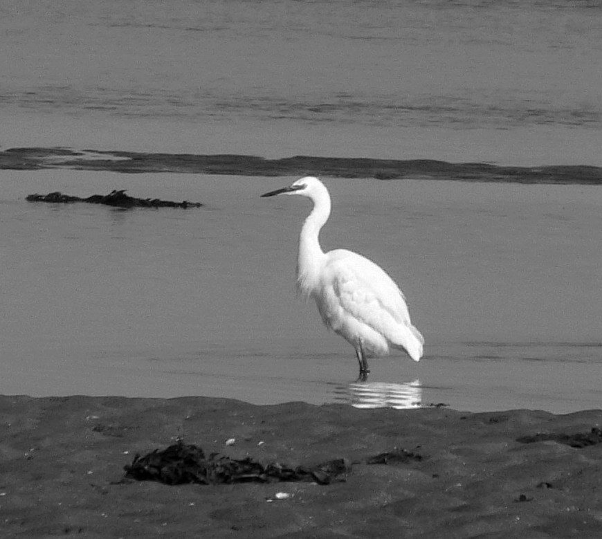
However you make the causeway crossing you’ll instantly be aware of the spectacular scenery as you approach from the mainland. On a clear day you’ll see the causeway ahead across the open sands and skirting the island fringe, the village and castle on the island itself, 2 pinnacle beacons, East and West Old Law on Guile Point at the end of Ross beach on the mainland to the south, the Farne Islands and Bamburgh Castle in the far distance and the wooden poles and refuge huts of the Pilgrim’s Way to your right. At sunrise, where the road bridge/Pilgrims Way cross the South Low river is a great place from which to photograph, as well as a feeding ground for all sorts of wading birds. You’re very likely to see swans looking picturesque on the river, perhaps a heron or the very beautiful little white egrets which sometimes visit.
Where the causeway becomes the approach to the village of Holy Island is called the Chare Ends Road. The main (Pay & Display) car park is there on the left. There’s another P&D carpark on Green Lane. (Bear toward the village end of Chare Ends) You might be lucky and find a free spot amongst the village lanes but it’ll probably be quicker to use the designated car parks.
The main street on the village is called Marygate. It won’t take long to orientate yourself. A lot of visitors will be heading towards the popular sites of Holy Island Castle, the Priory and Heritage Centre, if they’re not enjoying refreshment. You’re well catered for in that respect, all the pubs and cafes offer decent food and drink. Pilgrims Coffee House & Roastery is unusual, one of Northumberland’s first coffee roasteries, where you can see the process in operation and maybe fuel up or unwind before/after your explorations. Recommended.
Begin your walk on Marygate, heading east (right) from where Chare Ends Rd meets Marygate. The Heritage/Exhibition Centre is on the left and side of Marygate as you go but you might easily miss the charming Gospel Garden on the right hand side a little further on. This is a lovingly tended little oasis of calm. Have a quick look! At the top end of Marygate head left along Fiddlers Green. The cottages to your right are the eastern fringe of dwellings on the island and overlook Fenham Flats, which become flooded with the tides, and the mainland. Seal colonies congregate on sandbars on the Flats at low tide. If it’s a still day, or especially with a light westerly breeze, you’re likely to hear the peculiar tones of them ‘singing’ together. Further on, past St Mary’s Church on the left (well worth a look around) where the road becomes a track and wends down toward the shore, you might see the seals out there with a keen pair of eyes or binoculars.
At the shore you’ll see St Cuthbert’s Isle straight ahead, a small islet where the saint got away from the madding crowd and lived as a hermit. A cross stands on the isle and the ruins of a dwelling. You can walk to it at low tide but don’t use the causeway tide-tables as a guide to the encroaching tides because the water fills in here quite a while before the causeway becomes impassable. Keep an eye out! To the right on the shoreline an old lifeboat station has been turned into an interesting little museum/exhibition (Free entry) about the history of the lifeboat service in the area. To the left- the direction in which to continue your walk with a careful climb up the pathway onto the small cliff- you’ll see a lookout tower. The view from up on the small cliff or from within the lookout tower is one of Northumberland’s finest. Signs in the tower indicate the various landmarks on the horizons, most notably the Guile Point beacons at the end of the long sweep of Ross Sands immediately to the south, Bamburgh Castle & the other Farne Islands further to the south and Cheviot Hills to the west.
After the lookout, continue along the cliff path in the direction of the castle to the east. The path dips and comes out by the fisherman’s huts at the harbour. Holy Island still has a small population of working fishermen. The Herring Houses, dwellings closest to the harbour and bay, are a reminder of what was once the major industry in many coastal areas- herring fishing and processing. A community devoted to the herring harvest would have lived in the cottages and carried out much of their work in the cobbled courtyard within the quadrangle formed by the buildings. Observe the use of old boats to form sheds, another fishing community tradition. You’ll see some at the bay fringe amongst dry-docked boats.
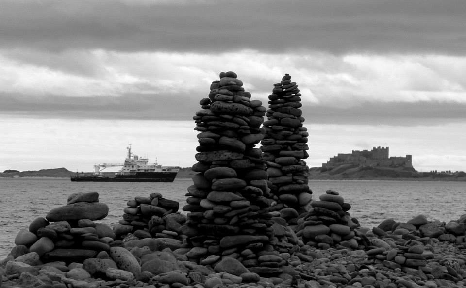
Have a look inside the modern slate and wood building just by the roadside near the bay. This is a relatively new visitor centre dedicated to the natural history of the island and with a viewing window over some natural wetland. Then continue your walk along the road toward the castle. Skirt the castle on the pathway just to the north. You’ll see and can look in on the little walled garden created by famous British horticulturalist Gertrude Jekyll in 1911 for the editor of Country Life magazine at the time, Edward Hudson. Before long, walking along one of the island’s old waggonways and under a small bridge, you’ll be at the island’s eastern shores and an interesting stretch closest to the castle where visitors create rock stacks, cairns and artwork with the rounded stones and pebbles in abundance thereabouts. A detour south from here takes you to the very well preserved lime kilns at Castle Point dating from 1860.
Continue northward from the vicinity of the castle along the grass path that follows the rugged shoreline. With a North Sea swell running there can be splendid surf and waves peeling from the various points and across the boulder reefs. You’ll eventually reach the distinctive white beacon at Emmanuel Head, the most easterly point on the island. Built between 1801-1810 and possibly the first daymark beacon in the UK, its purpose was to mark Emmanuel Head as distinct from another rocky point with similar features where boats often ran aground trying to locate a deep channel giving safe passage to the island.
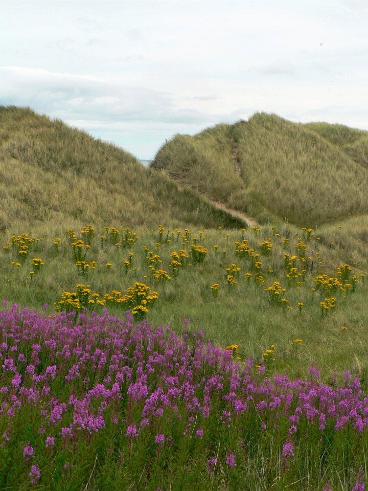
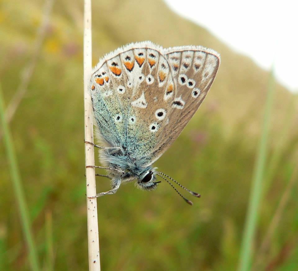
From Emmanuel Head you have good options to extend or curtail your walk. You’ll have covered about 2.5miles so far. Backtracking from Emmanuel Head for 200m or so you’ll come to the wall which marks the perimeter of the farmland on the island. Following that on the path in a westerly direction you’ll come to a gate at the end of a lane to the left. Follow that lane directly back to the village where you’ll find yourself emerging at St Coombe and Beblowe Farms. A circuit of approx 4miles in total. The scrub and dune land north of the farmland to the island’s north shore is a fantastic area of peaceful wilderness though and well worth a meander amongst. It’s bright with an abundance of flora in the Spring and Summer months and alive with other wildlife too, notably birds and butterflies. You can skirt this area by simply walking the pathways closest to the shoreline onward and westward from Emmanuel Head. Doing so you’ll come across the secluded and most likely deserted Sandham Bay and then Caves Haven Bay before reaching the wide open beaches of the north shore with a huge vista northward towards Goswick & Cheswick Sands, Cocklawburn Beaches and Berwick. Keep following the dune fringes and eventually there’s a sandy track across the narrowest point of the island, known as The Snook, between the north shore and a car-park by the causeway road. Cutting through the dunes here and walking back to the village beside the causeway road and along Chare Ends you’ll have covered a distance of approx 6.5miles. If you extend further and follow the shoreline right around Snook Point and then back along the road, rather than cutting through at The Snook, you’ll have covered a distance of about 8.5miles.
This map shows records within the ‘National Character Areas’ category that relate to a specific location. Click a marker to view the record to which it relates:
The North Northumberland Coastal Plain is a narrow, windswept strip that runs from the Anglo-Scottish border south to the mouth of the River Coquet, bounded by the sea to the east and the Northumberland Sandstone Hills to the west. The gently undulating inland plain is dominated by arable farming, with large, regular fields bounded by gappy hedgerows and in some places grey sandstone walls, with some pasture for beef cattle and sheep. Woodland cover is sparse and predominantly confined to the river valleys that meander across the coastal plain and the estate woodlands around Howick. The dramatic coastline is exceptionally varied, with rocky headlands and cliffs contrasting with long, sweeping sandy beaches backed by dunes, and extensive intertidal mudflats and salt marsh around Lindisfarne. The nationally important Whin Sill outcrops both inland and at the coast, supporting rare Whin grassland, and forming the distinctive rocky Farne Islands offshore.
The Northumberland Sandstone Hills curve across central Northumberland in a series of distinctive flat-topped ridges which provide panoramic views of the Cheviots and the coast. The ridgetops and upper slopes are covered with heather and grass moorland broken by large geometric blocks of conifer. Below this is pasture with some arable cultivation on the lower and dip slopes, broadleaved woodland on scarp slopes and along watercourses and a few notable parklands. There is a long tradition of rearing hardy sheep and cattle in this area. A number of major rivers flow east to the coast: the Wansbeck and Font arise in the Sandstone Hills while the Aln and Coquet break through from the Cheviot Fringe. The Till meanders through the lowlands of the northwest corner of the National Character Area (NCA). The Till and Coquet are designated for their biodiversity value and are important game fisheries. The Sandstone Hills play an important role in the recharge of the Fell Sandstone Aquifer; the quality and availability of water in this NCA are important for the supply of water locally and to northern Northumberland, and there are opportunities to help to reduce flood risk in this and downstream NCAs.
The Cheviot Fringe National Character Area (NCA) is a tranquil, undulating, lowland landscape, framed by the Cheviots NCA to the west and the Northumberland Sandstone Hills NCA to the east. The western edge falls within the Northumberland National Park and encompasses the edge of the Cheviot Hills. The importance of glacial processes in shaping this landscape is shown by the extensive array of glacial lake and fan deposits, sinuous ridges, eskers, kames and kettle holes. Weathering of the underlying bedrock combined with the widespread blanket of glacial and alluvial deposits have resulted in fertile soils that support the agriculture which dominates this area, and the river valleys provide much of the North East region’s sand and gravel resources. The vales to the south are a patchwork of arable farmland, pasture and meadows with the regular field pattern still strong, delineated by hedgerows punctuated with trees. To the north, arable cultivation dominates and the fields are flatter and larger with fewer hedgerows. Conifer blocks and shelterbelts are prominent in the landscape with broadleaved woodland predominantly along watercourses.
The distinctive, smooth, rounded hills of the Cheviots National Character Area (NCA) are part of the remote upland chain of the Northumberland moors which form the northern end of the Northumberland National Park. They rise steeply above the lowland belt of the Cheviot Fringe NCA to the north and east and the Border Moors and Forests NCA to the south. To the west, the rounded hills cascade into southern Scotland but the NCA is bounded by the Scottish border that follows a high natural ridgeline. The distinct igneous geology has formed a sinuous cluster of rounded hills with tors on some hill tops, rocky outcrops and scree slopes on the northern flanks, and many other glacial and post-glacial features. The wild, open upland landscape is dominated by rolling moorlands; there are extensive mosaics of heath, blanket bog and grassland, managed for sheep and cattle rearing and, grouse moors. Areas in the southern end of the NCA are also in use for military training. Large conifer plantations occur on some of the upper slopes, interrupting the smooth lines of the landscape.
This website uses cookies to improve your experience. We'll assume you're ok with this, but you can opt-out if you wish. Cookie settingsACCEPT
Privacy & Cookies Policy
Privacy Overview
This website uses cookies to improve your experience while you navigate through the website. Out of these cookies, the cookies that are categorized as necessary are stored on your browser as they are essential for the working of basic functionalities of the website. We also use third-party cookies that help us analyze and understand how you use this website. These cookies will be stored in your browser only with your consent. You also have the option to opt-out of these cookies. But opting out of some of these cookies may have an effect on your browsing experience.
Necessary cookies are absolutely essential for the website to function properly. This category only includes cookies that ensures basic functionalities and security features of the website. These cookies do not store any personal information.
Any cookies that may not be particularly necessary for the website to function and is used specifically to collect user personal data via analytics, ads, other embedded contents are termed as non-necessary cookies. It is mandatory to procure user consent prior to running these cookies on your website.