Ross Sands & The Beacons

Should your stricken conscience (If it is so) need some respite from ceaseless images in the media of plastic strewn seas and beaches then there’s no better place to visit, at the time of writing that is, than Ross Beach. Ross is one of Northumberland’s most vast and quietest beaches and a walk along the unspoiled sands to The Beacons at the northernmost point provides a good objective if you’re in the mood for more than simply relaxing at the seaside. You might see a washed up lobster pot, net float or fish box as you wander but why not carry a bag anyway and pick up any smaller litter that you do find? Honey Nuc likes to support the ethos of 2 Minute Beach Clean. https://beachclean.net/

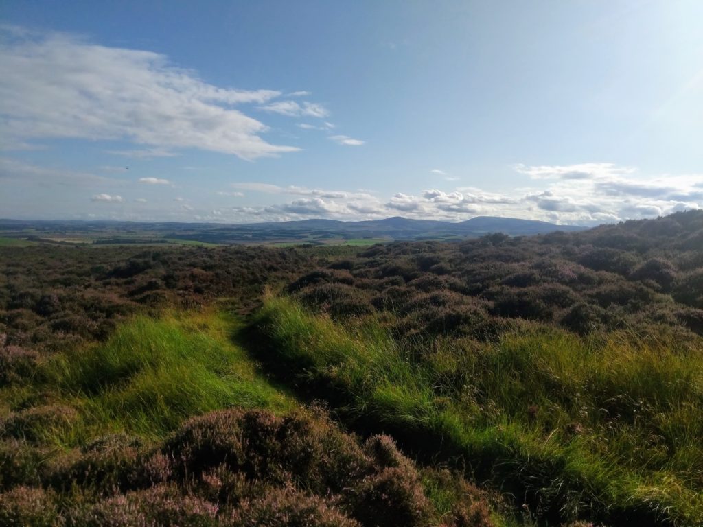
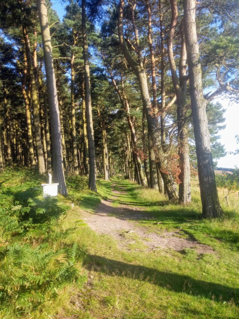
Perhaps the main reason for Ross being particularly crowd free is that there’s a walk of about a mile to the beach from the closest point (Ross Farm) at which you can park a car. I think it’s OK to cycle across the links between the farm and dune fringes of the beach. Certainly was when I was a lad. And you could lock bike/s to a fence amongst the dunes near the beach. The walk I’ll describe is a bit over 10km, 6.3m, and is out and back for the most part but with a loop section around midway.

Ross Farm (Belford NE70 7EN Grid Ref NU 133372) is about 6 miles from Honey Nuc by road. Take the A1 north, turn off right onto the un-named road at the junction opposite Belford Quarry, (This being the second junction off the A1 as you head N from Adderstone Mains road end.) cross the railway at Crag Mill crossing then turn left, carry on for about ¾ of a mile and take the first right which leads to Ross Farm. You’ll come to a point with signs indicating you can’t drive any further. Park there on verges to the left of the road and don stout walking shoes. Or trainers. Or even sandals. You shouldn’t have been driving without shoes on!

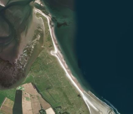
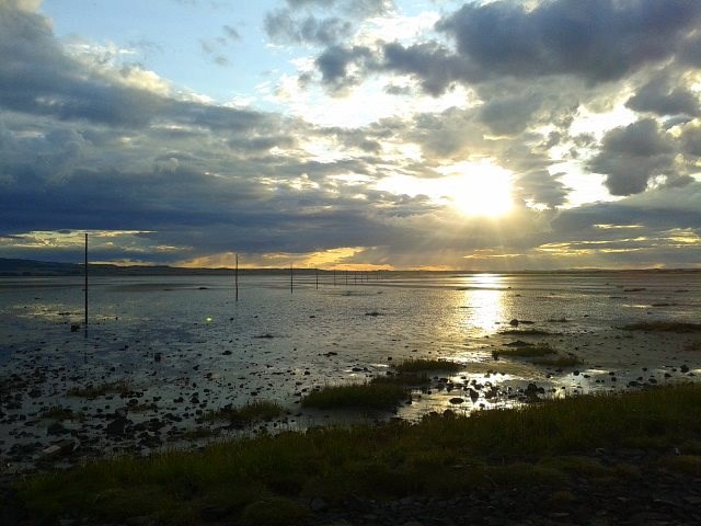
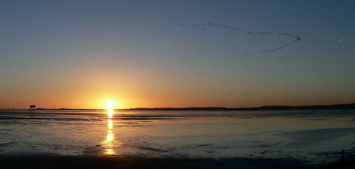
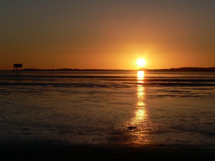
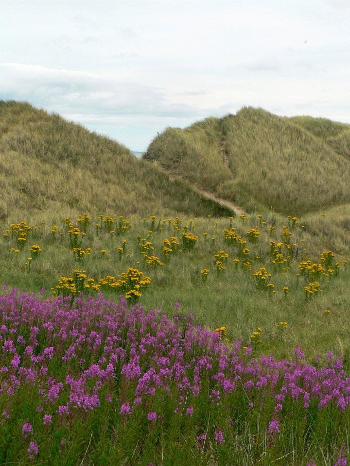
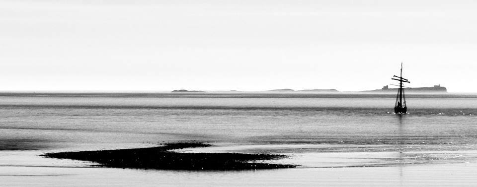
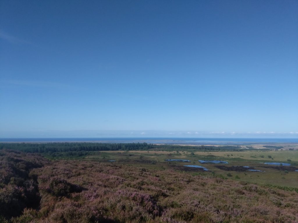
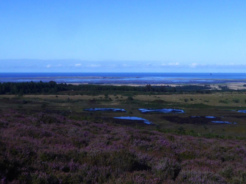
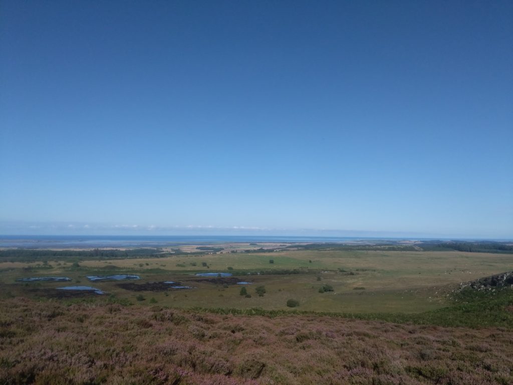
Walk straight along the road beside where parked, past the various cottages of Ross Farm and through the gate at the brick built Coastguard Cottages where Ross Links begin. Keep on the track and then hardcore path which becomes grassy as you approach the dunes. Through another smaller gate in the fence amongst the dunes and you’ll soon be at the sands where you’ll be met with a huge coastal vista of Ross Back Sands and Budle Bay bookended away to the north and south by Lindisfarne and Bamburgh Castles respectively. Quite a sight here if the North Sea (The area of sea just off the sands is called Skate Road) is broiling with a big swell, and on a day with millpond calm the sense of space and peace is uplifting. Dogs and small children alike are liable to flip into a frenzy of excitement trying to fill the emptiness.

Look northward along the beach and you’ll see the twin peaks of The Beacons just beyond the far dunes and across the water from Holy Island. About 2/3rds of the way along the sands to the north is an inlet between Ross dunes and those which form a small islet, Old Law, beyond and where The Beacons are. The inlet is called the Wide Opens and on big full tides it can flood with water through to Fenham Flats to the rear. Wide Opens doesn’t flood with much water when it does but keep the possibility in mind with the timing of your walk if you’re going all the way to The Beacons. Another possible obstruction to walking all the way to The Beacons, usually beyond Wide Opens, is the ground nesting of some seabirds during some of the Summer months. English Nature post signage about this restriction at Ross and on the beach as well as sometimes having wardens patrolling the beach to alert people.

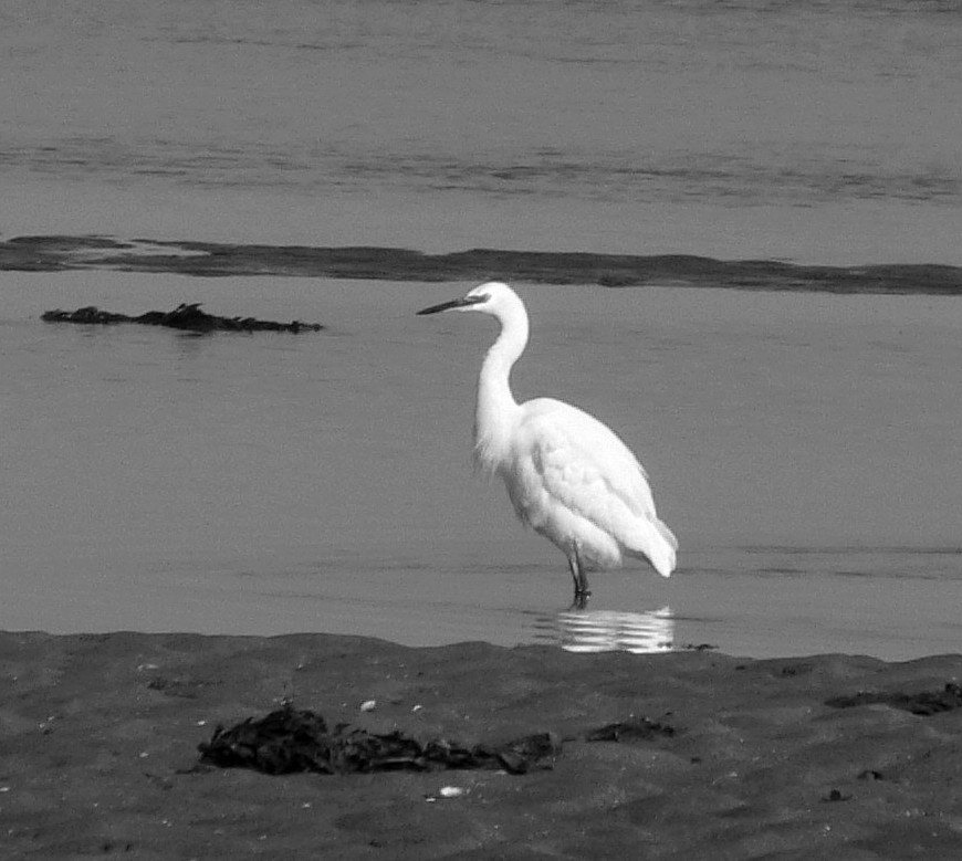
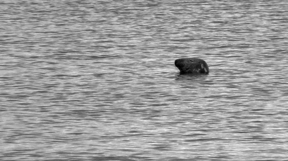
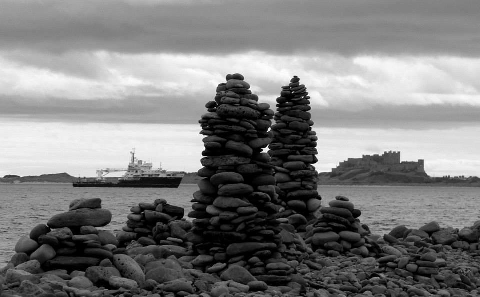
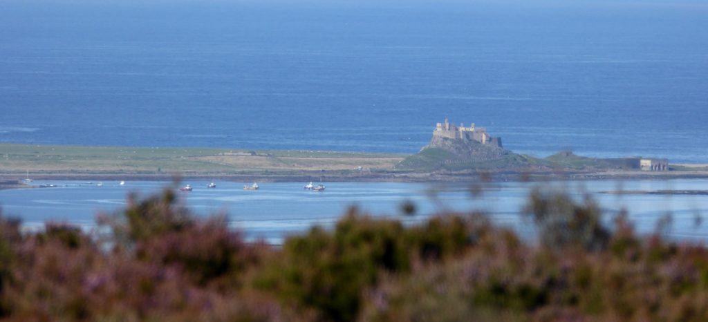
Once at the beach your walk is simply heading northward on the beach until you come to Guile Point where the Beacons are. The Beacons are called Guile Point (The eastely one) and Heugh Hill (Westerly) or sometimes Guile Point East & West, Old Law, and are described by Trinity House as wooden interior, stone clad obelisks, established in 1826. They are 21m and 24m high respectively, solar powered lights were added in the early 1990’s and they mark safe passage for vessels approaching Holy Island Harbour. Guile Point is a good place for watching seals which are often swimming close by shore in the waters there. When I last visited a colony of them was basking on the sands at the point.

Rounding the point you can continue on the landward side of Old Law until you come to Wide Opens again and cut through there back to the beach. On the landward side of Old Law you’ll look across Fenham Flats toward the mainland. The whole area of the flats fills up at toward high tide and this flooded area is what isolates Holy Island twice a day. Fenham Flats is also the location of the oyster beds of the highly respected Lindisfarne Oysters based at Ross Farm. There’s a lovely area of the high water mark on this landward side of Old Law where broken seashells have encrusted the sand/mud tideline to form a natural mosaic pathway.

Once you’ve rounded Old Law and cut back through Wide Opens to the beach the return leg of the route is simply to retrace your steps back along the beach and across the dunes and links to Ross Farm again. You could extend a little by going as far south on Ross Back Sands as you wish. The beach becomes the inlet of Budle Bay at the southerly, Links End, point. Budle Bay also floods with the tide incoming toward full.

This route can be downloaded in the following formats GPXKMLTCXFITJPGGIFPNGPDF. (click the button below to download):

Holy Island Off the Beaten Track

The Holy Island Of Lindisfarne, quickly accessible from mainland Northumberland via the approach road off the A1 at Beal and then across the causeway at low tide, is a very popular destination for visitors to Northumberland. Perhaps it’s become something of a ‘must do’ destination which is hardly surprising considering its unusual location, natural beauty, wealth of places to visit and early Christian and Viking history. Nearly all visitors travel there by car, many by bike and, especially around Easter time, numbers of folk make the traditional pilgrimage across the sands beside the causeway on foot following the Pilgrim’s Way, a line of tall wooden poles marking the shortest route. The island is at the start/end of the St Cuthbert’s Way, Melrose in the Borders being the other extreme, another reason for increasing numbers of walking visitors- and participants in ultrarunning events using the island as a start/finish point. It can get very busy during holiday periods, irrespective of the weather, but what is surprising is that relatively few visitors seem to disperse far beyond the environs of the village on the island to be absorbed by the natural beauty of the place. This blog entry will take you on a walk which skirts the village, points out some less frequented spots and things to look out for, and guides to the island’s fantastic coastline and semi-wilderness of dune habitat.

Assuming travelling by car (by any means for that matter) the only word of caution is to pay attention to the tide tables!! Times that the causeway connecting the island with the mainland is passable or not are readily available online and on notice-boards at the mainland end of the causeway. Almost always those who get caught by the tide are unwary visitors trying to beat an incoming tide in their rush to leave. Their car becomes waterlogged in deeper water near the bridge on the causeway, they are then precariously stranded until, at considerable cost, emergency services are rallied to rescue them. They are resoundingly pilloried on social media and become part of the ongoing debate as to whether emergency service assistance should be charged to them and or their (most likely less than sympathetic) insurers. Such a situation could be the dire ending to what had been a very nice day out indeed. Don’t get into it.

Holy Island Tide Times

However you make the causeway crossing you’ll instantly be aware of the spectacular scenery as you approach from the mainland. On a clear day you’ll see the causeway ahead across the open sands and skirting the island fringe, the village and castle on the island itself, 2 pinnacle beacons, East and West Old Law on Guile Point at the end of Ross beach on the mainland to the south, the Farne Islands and Bamburgh Castle in the far distance and the wooden poles and refuge huts of the Pilgrim’s Way to your right. At sunrise, where the road bridge/Pilgrims Way cross the South Low river is a great place from which to photograph, as well as a feeding ground for all sorts of wading birds. You’re very likely to see swans looking picturesque on the river, perhaps a heron or the very beautiful little white egrets which sometimes visit.

Where the causeway becomes the approach to the village of Holy Island is called the Chare Ends Road. The main (Pay & Display) car park is there on the left. There’s another P&D carpark on Green Lane. (Bear toward the village end of Chare Ends) You might be lucky and find a free spot amongst the village lanes but it’ll probably be quicker to use the designated car parks.

The main street on the village is called Marygate. It won’t take long to orientate yourself. A lot of visitors will be heading towards the popular sites of Holy Island Castle, the Priory and Heritage Centre, if they’re not enjoying refreshment. You’re well catered for in that respect, all the pubs and cafes offer decent food and drink. Pilgrims Coffee House & Roastery is unusual, one of Northumberland’s first coffee roasteries, where you can see the process in operation and maybe fuel up or unwind before/after your explorations. Recommended.

Begin your walk on Marygate, heading east (right) from where Chare Ends Rd meets Marygate. The Heritage/Exhibition Centre is on the left and side of Marygate as you go but you might easily miss the charming Gospel Garden on the right hand side a little further on. This is a lovingly tended little oasis of calm. Have a quick look! At the top end of Marygate head left along Fiddlers Green. The cottages to your right are the eastern fringe of dwellings on the island and overlook Fenham Flats, which become flooded with the tides, and the mainland. Seal colonies congregate on sandbars on the Flats at low tide. If it’s a still day, or especially with a light westerly breeze, you’re likely to hear the peculiar tones of them ‘singing’ together. Further on, past St Mary’s Church on the left (well worth a look around) where the road becomes a track and wends down toward the shore, you might see the seals out there with a keen pair of eyes or binoculars.

At the shore you’ll see St Cuthbert’s Isle straight ahead, a small islet where the saint got away from the madding crowd and lived as a hermit. A cross stands on the isle and the ruins of a dwelling. You can walk to it at low tide but don’t use the causeway tide-tables as a guide to the encroaching tides because the water fills in here quite a while before the causeway becomes impassable. Keep an eye out! To the right on the shoreline an old lifeboat station has been turned into an interesting little museum/exhibition (Free entry) about the history of the lifeboat service in the area. To the left- the direction in which to continue your walk with a careful climb up the pathway onto the small cliff- you’ll see a lookout tower. The view from up on the small cliff or from within the lookout tower is one of Northumberland’s finest. Signs in the tower indicate the various landmarks on the horizons, most notably the Guile Point beacons at the end of the long sweep of Ross Sands immediately to the south, Bamburgh Castle & the other Farne Islands further to the south and Cheviot Hills to the west.

After the lookout, continue along the cliff path in the direction of the castle to the east. The path dips and comes out by the fisherman’s huts at the harbour. Holy Island still has a small population of working fishermen. The Herring Houses, dwellings closest to the harbour and bay, are a reminder of what was once the major industry in many coastal areas- herring fishing and processing. A community devoted to the herring harvest would have lived in the cottages and carried out much of their work in the cobbled courtyard within the quadrangle formed by the buildings. Observe the use of old boats to form sheds, another fishing community tradition. You’ll see some at the bay fringe amongst dry-docked boats.

Have a look inside the modern slate and wood building just by the roadside near the bay. This is a relatively new visitor centre dedicated to the natural history of the island and with a viewing window over some natural wetland. Then continue your walk along the road toward the castle. Skirt the castle on the pathway just to the north. You’ll see and can look in on the little walled garden created by famous British horticulturalist Gertrude Jekyll in 1911 for the editor of Country Life magazine at the time, Edward Hudson. Before long, walking along one of the island’s old waggonways and under a small bridge, you’ll be at the island’s eastern shores and an interesting stretch closest to the castle where visitors create rock stacks, cairns and artwork with the rounded stones and pebbles in abundance thereabouts. A detour south from here takes you to the very well preserved lime kilns at Castle Point dating from 1860.

Continue northward from the vicinity of the castle along the grass path that follows the rugged shoreline. With a North Sea swell running there can be splendid surf and waves peeling from the various points and across the boulder reefs. You’ll eventually reach the distinctive white beacon at Emmanuel Head, the most easterly point on the island. Built between 1801-1810 and possibly the first daymark beacon in the UK, its purpose was to mark Emmanuel Head as distinct from another rocky point with similar features where boats often ran aground trying to locate a deep channel giving safe passage to the island.

From Emmanuel Head you have good options to extend or curtail your walk. You’ll have covered about 2.5miles so far.  Backtracking from Emmanuel Head for 200m or so you’ll come to the wall which marks the perimeter of the farmland on the island. Following that on the path in a westerly direction you’ll come to a gate at the end of a lane to the left. Follow that lane directly back to the village where you’ll find yourself emerging at St Coombe and Beblowe Farms. A circuit of approx 4miles in total. The scrub and dune land north of the farmland to the island’s north shore is a fantastic area of peaceful wilderness though and well worth a meander amongst. It’s bright with an abundance of flora in the Spring and Summer months and alive with other wildlife too, notably birds and butterflies. You can skirt this area by simply walking the pathways closest to the shoreline onward and westward from Emmanuel Head. Doing so you’ll come across the secluded and most likely deserted Sandham Bay and then Caves Haven Bay before reaching the wide open beaches of the north shore with a huge vista northward towards Goswick & Cheswick Sands, Cocklawburn Beaches and Berwick. Keep following the dune fringes and eventually there’s a sandy track across the narrowest point of the island, known as The Snook, between the north shore and a car-park by the causeway road. Cutting through the dunes here and walking back to the village beside the causeway road and along Chare Ends you’ll have covered a distance of approx 6.5miles. If you extend further and follow the shoreline right around Snook Point and then back along the road, rather than cutting through at The Snook, you’ll have covered a distance of about 8.5miles.

This route can be downloaded in the following formats GPX, KML, TCX, FIT, JPG, GIF, PNG, PDF. (click the button below to download):

St Cuthbert’s Cave (Cuddy’s Cove) From Belford.

Visitors to Honey Nuc will enjoy the peace and quiet of the immediate surroundings and can take gentle walks on the tracks around the surrounding farmland, occasionally abundant and colourful with wild flora and fauna. But only a couple of miles to the North the village of Belford is well placed as a good start point for longer walks/runs/cycle rides, and has various options for refreshment thereafter!

Here’s an outline of such a venture, a 10 mile country walk on tracks, paths and lanes. It’s a route I’ve used as a training run many times, which one of the local schools often followed for the annual sponsored walk, and which is also mostly rideable on mountain or cyclocross bikes although there are quite a lot of gateways. Nothing too strenuous, and great panoramic views along the way of the best of what Northumberland has to offer slightly further afield- the rolling Cheviots to the West and vast open coastline to the East. The highlight en-route, although not the literal high point, is the National Trust site of St Cuthbert’s Cave, (known locally as ‘Cuddy’s Cove’) a sandstone rock overhang/cave nestled in woodland, reputedly a temporary resting place for monks transporting the body of St. Cuthbert on fleeing Holy Island after Viking invasion circa AD875. The route can be shortened by starting at alternative points or short-cutting, and still taking in Cuddy’s Cove. I’ll mention these options in progression.

The War Memorial/ West Street Well/ Old abandoned Community Club NU 106 338 approximately half way up the built-up part of West Street (B6349 to Wooler, from Belford Mkt Sq) in Belford is your start point. There’s nearly always space to park right in front of the War Memorial. At the time of writing Belford’s sorry lack of a public village hall space has probably fuelled rumours that the desertion of formerly thriving venues which might serve the purpose, such as the Old Abandoned Community Club at the War Memorial or the boarded up Middle School, isn’t down to political and business ineptitude but rathermore due to hauntings! Such superstitions thrive in isolated rural communities. Fans of the paranormal and Scooby Doo alike will thrill to tales which circulate in the village of Country & Western tunes and the clinking of glasses from unidentifiable sources wafting across the streets. As well as the eerie early morning groans of schoolchildren being herded onto buses by mysterious forces and spirited away to far-off educational establishments.

Ponder such weirdness and offer respects to those killed in the wars, then begin your perambulatory escape from it all by taking the West Hall Lane immediately to the left of the War Memorial/ Abandoned Club. 

Crossing the Belford Burn you’ll soon come to West Hall Farm with its castellated fortress-like farmhouse to the left and wooded crags to the East. Follow the farm track between the steading buildings and farm cottages and on up the hill to Craggy Farm. Keep straight on through Craggy Farm steading and the metal gate with the old lime kiln just beyond to the right. There are several examples of such kilns dotted around the North Northumberland coastal area. Visitors to Honey Nuc may already have noticed a fine example on the approach road to the cottage shortly after turning off the A1. Following the track between the wall on the left and small crags to the right you’ll go through another metal farm gate, straight across a field and into Middleton Square Wood via a wooden gate.

The meandering path through the wood meets a track. Bear left and after about 100m continue straight on up the road which the track meets at the edge of the wood.

In about quarter of a mile where the road ends you’ll come to Swinhoe Farm NU 083 350 having covered about 2 miles. 

Swinhoe could be an alternative start & finish point for the walk. Park respectfully by the cottages if doing so. The loop from there is about 6 miles. The return leg from Swinhoe to Belford on the longer route is simply the reverse of what I’ve described already or an alternative I’ll outline later. 

I’ll describe the loop anti-clockwise from Swinhoe. Take the track away from the farm that bears right, through the gate and towards the woodland ahead.  The secluded and peaceful Swinhoe Lakes are tucked away just inside the woodland where the track begins to skirt the trees. A short climb up Virgin Hill and the track turns into the woods then comes out again onto open moors at a gate around about the 3 mile point. Keep the craggy outcrop which forms the top of Fawcett Hill to your right and the grass path brings you to a stile and track. At this point on a clear day you’ll have the first of magnificent views of the North Northumberland coast from Budle Bay, over Holy Island and all the way to Berwick. Also an option here to short cut the route by about 2.5 miles. Looking left/ West you’ll see Greensheen Hill over which the long route passes, and trees at the horizon which are the Eastern edge of the woodland in which Cuddy’s Cove is. If shortcutting then don’t cross the stile but rather head left across the moor on the grassy track heading for the point at the Northerly edge of the treeline/ Southerly end of Greensheen. The longer route comes to the same point later in its course and to continue on that then cross the stile, bear left on the track and follow through 2 gates as the track bears to the right and approaches Detchant/ Kyloe Woods with the pond to the right. As you enter Detchant/Kyloe Woods you’ll have covered about 4 miles and the next mile is simply keeping straight onward on the track through the woods, ie- ignore the right fork just after going into the trees. The track begins to descend and curve gradually through the woods, passes through a wooden gate, then descends a little more steeply and curves around the small Raven’s Crag to the right before exiting the trees at another wooden gate where you’ll start to get views of The Cheviot Hills. For about quarter of a mile the track is more grassy and undulating eventually coming to a small plantation and stone wall at the end of the Holburn track. Turn sharp left at this point, keep the wall to your right and follow the foothpath/sheep trod up the short steep incline through the gorse patches until you come to the wooden gate in the wall. You’ve started the climb of Greensheen Hill. The track after the gate flattens for a while and you’ll see another pond, the Gull Pond (Birdspotting!) to the left as it starts to climb again to Greensheen summit and trig point at about the 6 mile point. Fantastic views from here, even more expansive than before looking Eastward across the coast, Bamburgh and the Farnes now visible, and the Cheviots dominant to the West. Magical at sunrise or sunset! 

Straight on and downward from Greensheen summit the track narrows to a twisting and occasionally stony path through the heather and eventually comes to the edge of Cuddy’s Cove wood and the point previously mentioned if shortcutting. You can shortcut straight into the wood to the cave from here or descend its northern edge and meet the grassy path which approaches from Holburn Grange Farm. (Which is the closest point visitors to the Cave can drive to and walk from.) The path is at the West edge of the wood and Cuddy’s Cove obvious in a lovely West facing clearing on a branch from it. Enjoy exploring and clambering about the cave and surrounding rocks with care. Great spot for picnicking and sunbathing. Afterward keep straight onward on the grass path as it exits the wood at the other (more Southerly) end. There’ll be open fields to your right and the wooded Cockenheugh Hill to your left. Nestled under this flank of Cockenheugh and close by the track you’ll find other pillars/ towers of sandstone, same geological origin as Cuddy’s Cove, alternative places to climb, clamber and perch and admire the scenery. The track becomes a pathway passing within another section of woodland as it keeps skirting Cockenheugh, before exiting at a gateway, where it becomes a defined farm track, and descending at the edge of a field. Another gateway/stile at the bottom end of the field, then a dip and rise with the empty/ruined steadings of Dick’s Old Walls to the left. A descending section of hardcore track brings you back to Swinhoe Farm to retrace your earlier steps to Belford.

An alternative return to Belford from Swinhoe is to turn right between the cottages and steading/farmhouse and follow the public footpath skirting the field in front of the small hill with the telecomms mast atop. Keep on along the path following the ridge after the gate at the mast until you pass through another gate. Across the field to your right you’ll see Plantation Farm and closer by the wooded Juniper Hill. Keep Juniper Hill to your right and descend to the stone stile/wall at the Craggy Farm (over to the left) and West Hall Farm (ahead) boundary. Cross the stile and two fields with small wooded dene between, then turn left at the wicket gate and into the far end of the field where the castellated West Hall Farmhouse is. Follow the chattering Belford Burn amongst the trees and come out onto the West Hall Lane at another wicket gate just 50 yards from your start point.

This route can be downloaded in the following formats GPX, KML, TCX, FIT, JPG, GIF, PNG, PDF. (click the button below to download):