Honey Nuc isn’t far from several Neolithic/ Bronze Age sites of interest which make for unusual excursions, with short and scenic walks in each case. Visits to the 3 sites mentioned here could make for a full day out on an ancient archaeology theme.
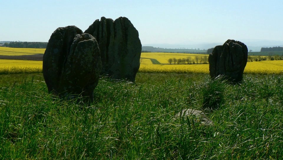
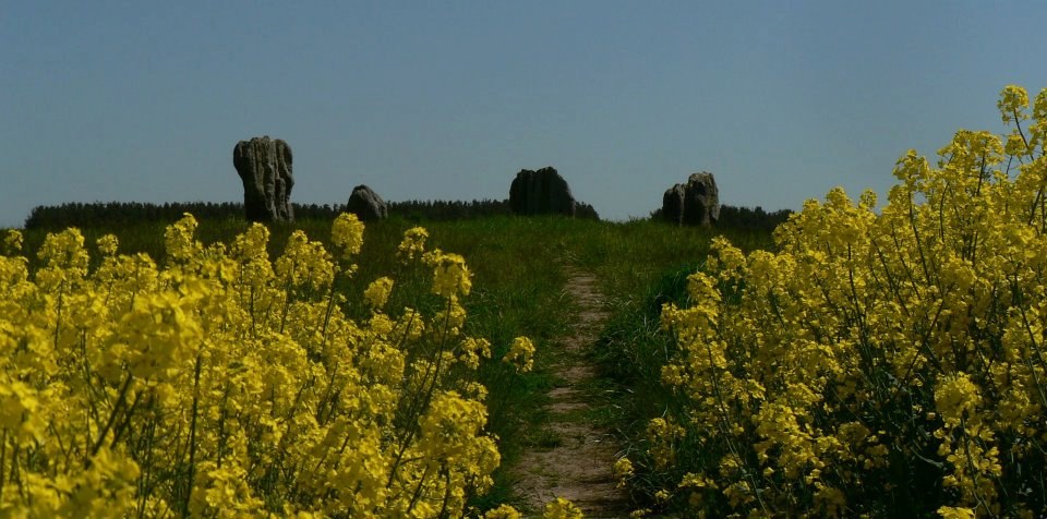
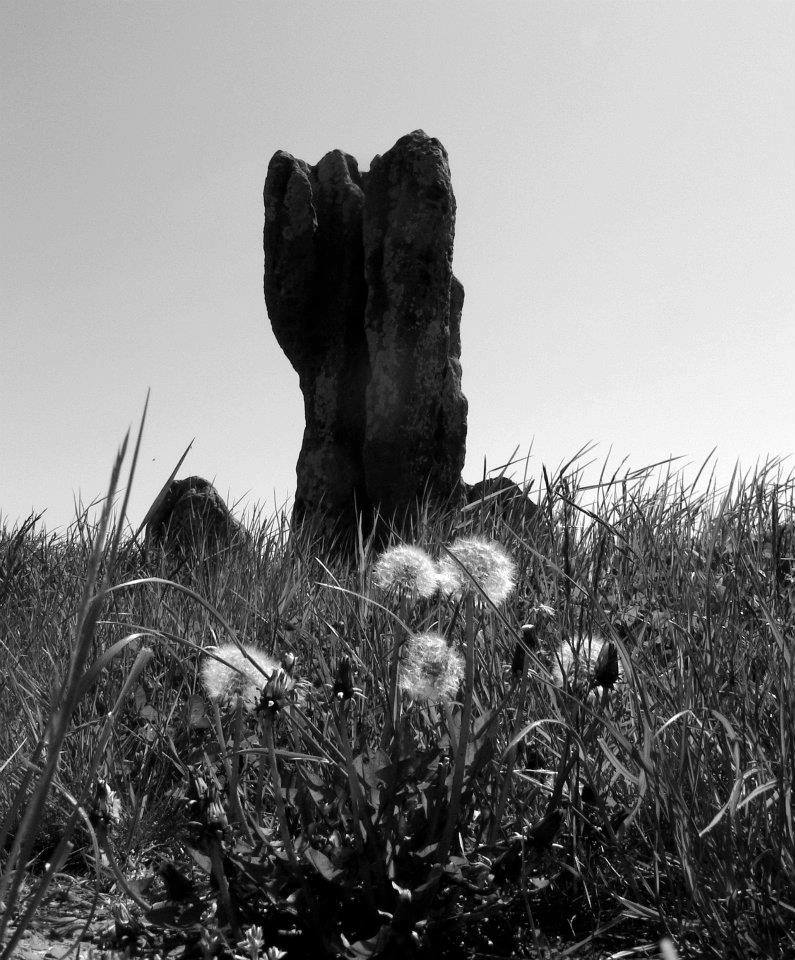
Duddo Stones (Grid Ref NT 930437) is a Bronze Age Stone circle, 5 intriguingly weathered upright stones of about 6ft high atop a slight ridge, from which there are wide views of the Cheviot Hills to the SW, Eildons and Lammermuirs to the W and N. There’s a lot of open countryside surrounding, albeit farmland, which, along with the distant hills, gives a sense of vastness and peace. A great place to visit for a warm sunset or a frosty morning. Pause and wonder at the motivations of ancient ancestors for their efforts in creating.
Duddo is about 20 miles from Honey Nuc. Turn off the B6354 at the junction in Duddo hamlet at the farm. A fingerpost sign points W, an unclassified road which heads to Tiptoe and Shellacres farms There’s also a small signpost at the same spot- ‘Stone Circle.’ Park on the verge about quarter of a mile along that road at the metal gate (more signage in the hedgerow there) immediately after the strip of woodland on the right and enjoy the walk of about 1km along the permissive path/track. You’ll see the stones up ahead most of way along.
Not far S from Duddo, and about midway between Duddo Stones and Roughting Linn, you’ll find the villages of Ford & Etal, and Heatherslaw Mill. A plethora of more tourist attractions to choose from at these locations.
The picturesque ‘model’ village of Etal boasts neat whitewashed cottages with unusual stone slabbed roofs, a castle and museum, St Mary’s Church in the grounds of Etal Manor, food & ale at the thatch-roofed Black Bull Inn or refreshment at the Post Office Lavender Tearooms. A narrow gauge steam railway runs the short distance between Heatherslaw and Etal alongside the River Till. Heatherslaw has a working watermill, cafe, gallery and visitor centre as well as the steam railway station. Nearby at Hay Farm are the magnificent heavy horses.
Ford village has an unusual reclamation centre/shop and tearooms at the Old Dairy on the hill. Some lovely stained glass windows in St Michael’s Church. Artwork and local history information in The Lady Waterford Hall.
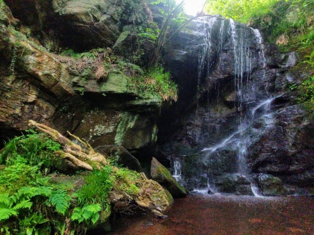
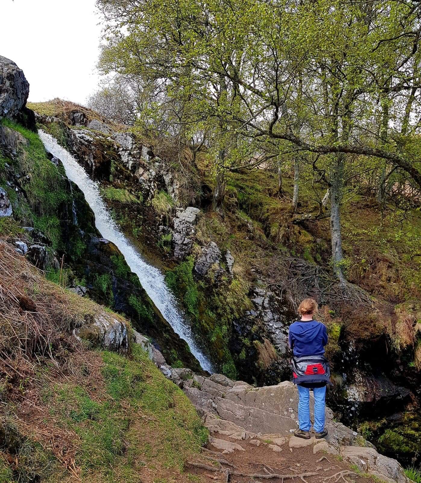
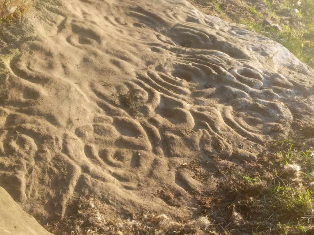
Roughting Linn or Routin’ Linn (NT 984367) is a farm SW of Lowick which is about 12 miles from Honey Nuc. Here you’ll find several examples of Neolithic/Bronze Age ‘rock art’ in the form of cup and ring markings on outcrops of rock in shady woodland just to the right hand side of the start of the farm track and near the roadside. As well as the cup and ring markings there’s a rather beautiful little waterfall in a leafy green grotto along a short pathway down through the woods on the left hand side of the farm track. There is a sign at the roadside indicating Roughting Linn Farm but neither the waterfall or the cup and ring markings are signed so there’s a sense of adventure in finding them. Some parts of the pathway to the waterfall are steep and can be slippy. As well as weathering, visitors exploring the rocks to look at the cup and ring markings also contribute to the gradual erosion of these ancient marvels. The general advice is to avoid walking on them as far as is possible!
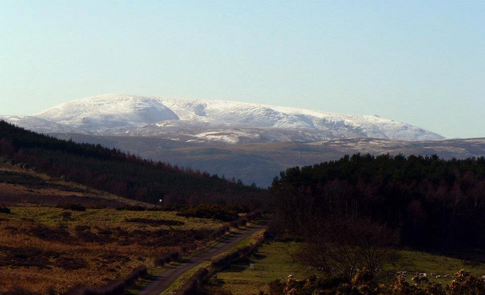
If using Satnav or Google Maps to locate Roughting Linn the postcode to use is TD15 2QF. (There’s another Roughting Linn in the Alnwick NE66 vicinity) Turn off the B6525 Lowick-Wooler road about a mile S of Lowick on the unclassified road heading W towards Kimmerston. Crossing Barmoor you’ll pass the entrance to Barmoor South Moor Farm and then the wind turbines. Ahead a splendid view of The Cheviot before the road starts to descend. Roughting Linn farm track is on the right hand side of the road at the next woodland. Park anywhere on the verges to the side of the little road opposite and continue your exploration on foot.
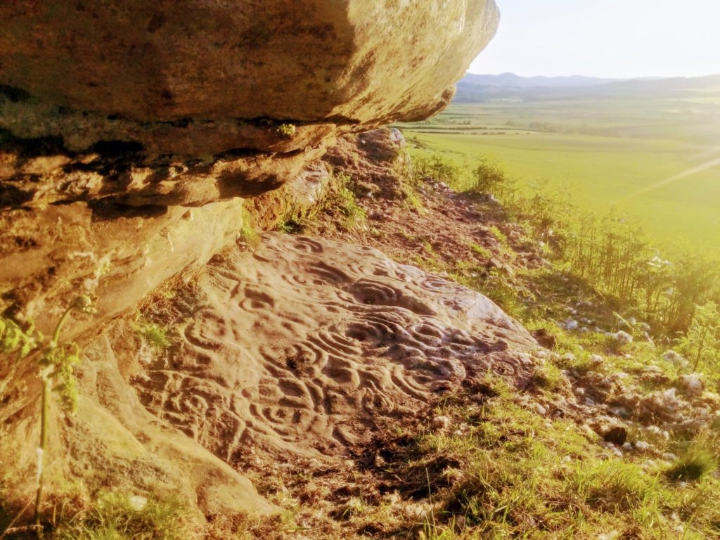
Ketley Crag (NU 074298) is closest to Honey Nuc (Approx 4 miles) of these 3 sites, perhaps the trickiest to find, but has one of the finest examples of ancient rock art in North Northumberland. Amongst the small craggy outcrops of rock with fine views W to the Cheviots, wonderful on a summer evening when the light warmly illuminates, is one overhang with a flat stone ‘table’ beneath covered in an ornate flow of cup and ring markings.
Marvellous to sit and contemplate the artistry, at least for a while before, perhaps, the lure of ever-reliably good food and drink at the nearby Percy Arms in Chatton Village!
Approach by parking near the top of Chatton Park Bank on the right (if heading toward Chatton) of the B6348 shortly after the junction with the road across the moor to Belford. Over the stile on the wall and up over Chatton Park Hill, (where there are other examples of rock art on some exposed rock surfaces) after about 1km you’ll start to descend into Lyham Burn valley. Ketley Crags are to the left of a strip of woodland overlooking the valley and Lyham Hill Farm beyond.
The Megalithic Portal Published 24th September 2014 https://www.megalithic.co.uk/article.php?sid=883 accessed 13th July 2019