This short out and back walk of about 2.5 miles involves a modest climb on track and footpath leading to a ruined shepherd’s house with an Iron Age hillfort and burial cists en route. The walk could be extended to further explore the open moorland beyond the ruin and other points of interest which I’ll mention.
Start point is Old Bewick Farm, about 20mins drive from Honey Nuc. Take the A1 south and then first right after about quarter of a mile onto the B6348 for Chatton. When you’re almost through Chatton village take a left heading south on the B6346 toward Alnwick. You’ll pass through Chillingham on this road and after approximately another 3miles and a series of bends in the road at the crest of a hill reach Old Bewick Farm at the left hand side of the road. Postcode NE66 4DZ and Grid Ref NU 0666 2150.
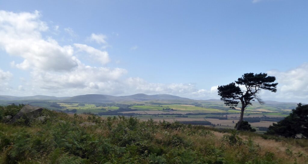
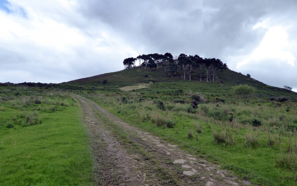
Park with consideration on the verges by the farm buildings at the roadside. Start the walk by keeping to the track closest to the farm cottages. You’ll see Bewick Hill and Hanging Crag with Scots Pine trees overlooking the farm to the right. Old Bewick Hillfort is atop the hill to the right side of the crags. From the gateway at the foot of the hill there is supposedly a footpath which branches from the track, contours the hill and comes to the hillfort. My friend and I found that this petered out and was overgrown with bracken. We backtracked, continued up the track toward the back of the hill then bore off to the right and approached the hilltop via the small rectangular plantation of trees there. Atop Hanging Crag gives a splendid view of the Cheviot Hills. The Iron Age hillfort is a series of raised earthworks. There are more recent fortifications in the form of WW2 pillboxes and cup and ring rock markings on nearby freestanding boulders.
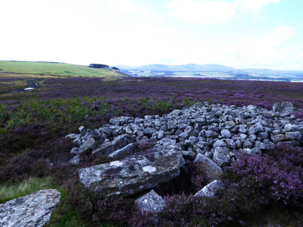
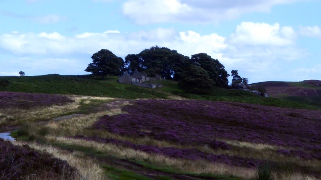
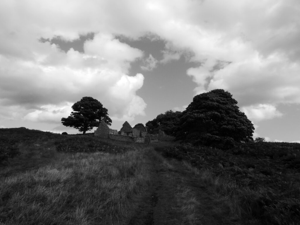
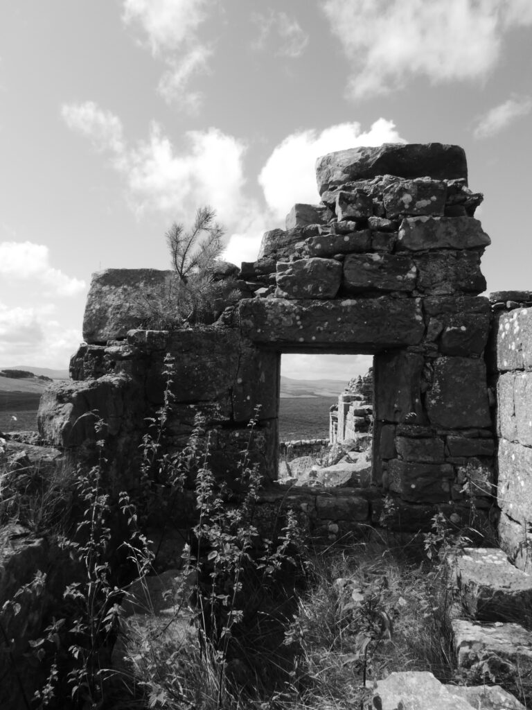
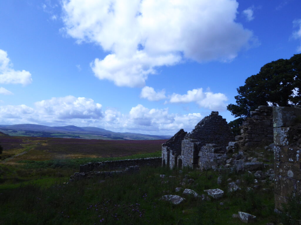
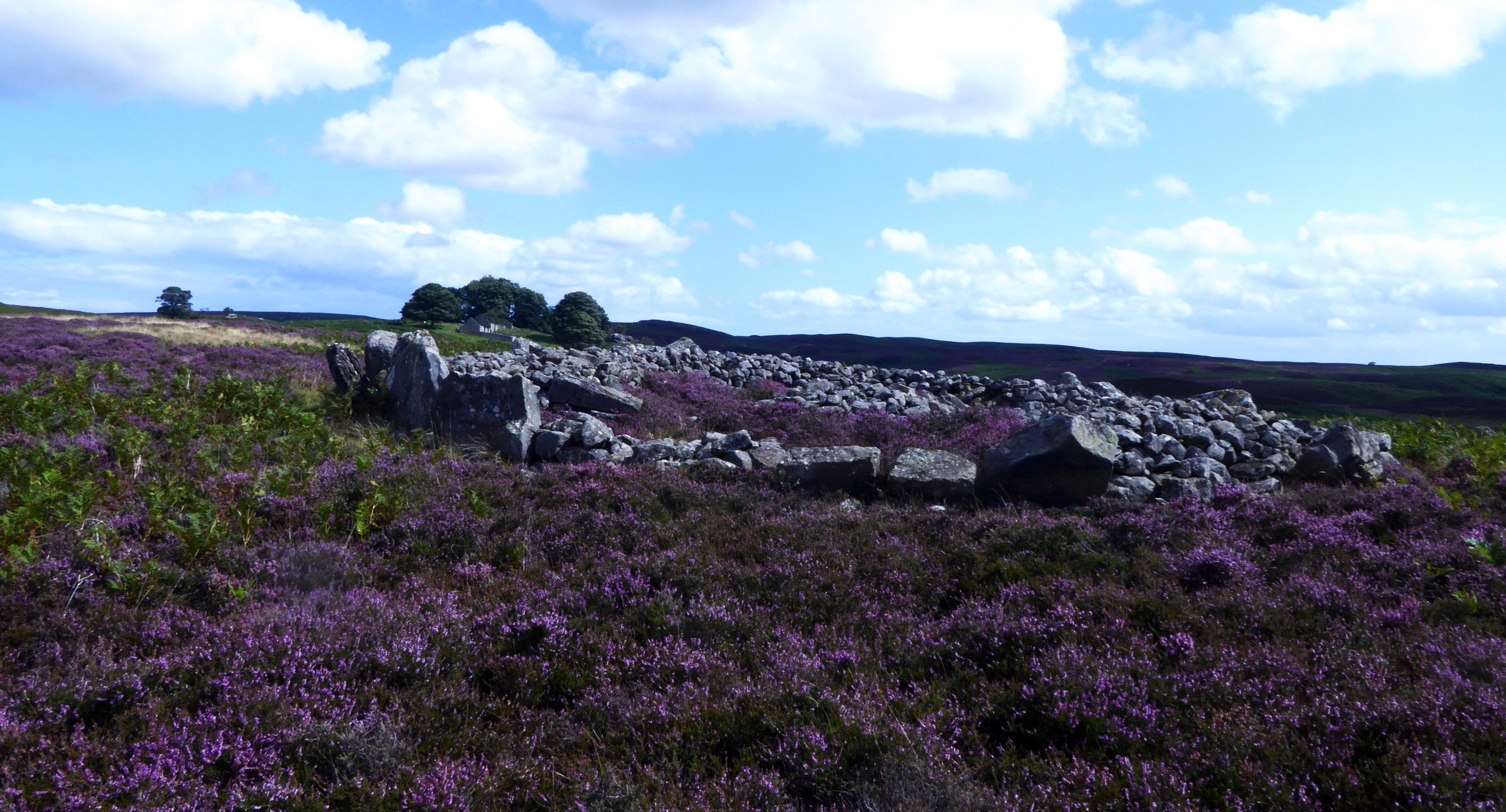
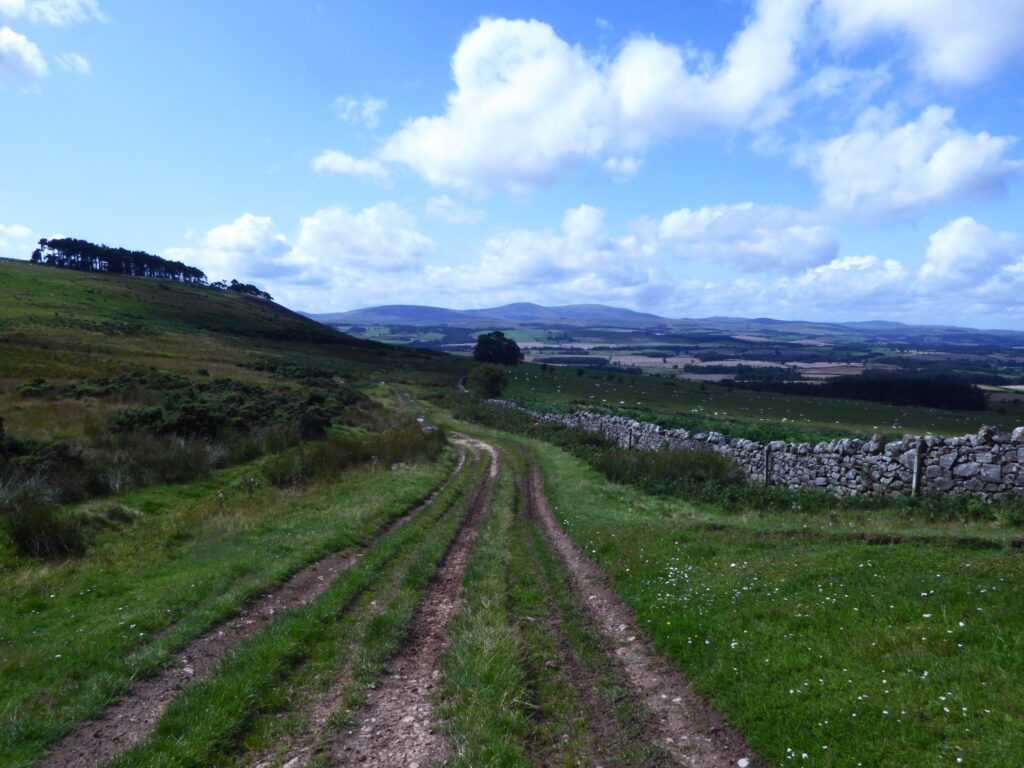
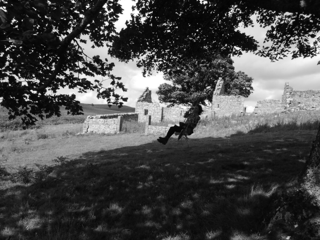
Returning to the main track up from the farm it starts to level out on to the wider moorland after the climb around the hill. The moors are quite an expansive area of near wilderness. Before long the ruined Blawearie (Weary of the wind!) Shepherd’s House comes into view straight ahead. Detour slightly off to the left of the track about quarter of a mile beforehand to see the stone burial cists amongst the heather there. I always find the vicinity peaceful, eerie and intriguing. A sense of awe at the expansiveness of the vista and wonderment if it was simply that same feeling which drove the ancients and the more recent inhabitants at the house to make settlements there. The house was requisitioned in WW2 and the family living there at the time chose not to return. Thereafter it fell into ruins. It’s a great location to explore and photograph in and around, sitting amongst mysterious and shadowy rock outcrops overhung with trees and bushes, some of the nearby trees strung with makeshift swings.

Various footpaths branch out across the moors. Heading south and not far from the Shepherd’s house ruin is Blawaerie Hillfort at NU 0875 2199 and the nearby Corbie and Greymare Crags. Roughly northeast and a bit further afield the Cateran Hole, a subterranean chamber which can be accessed on foot. I intend to describe this in a later blog post but with an approach from the Quarryhouse road across the moors from near Chillingham & Hepburn Woods and also taking in Ros Castle Hill.
Nearest options for post walk refreshment are the Tankerville Arms at Eglingham a bit further south from Old Bewick on the B6346 toward Alnwick or the Percy Arms back the way at Chatton.